


Updated 5:32 p.m. MDT May 6, 2022
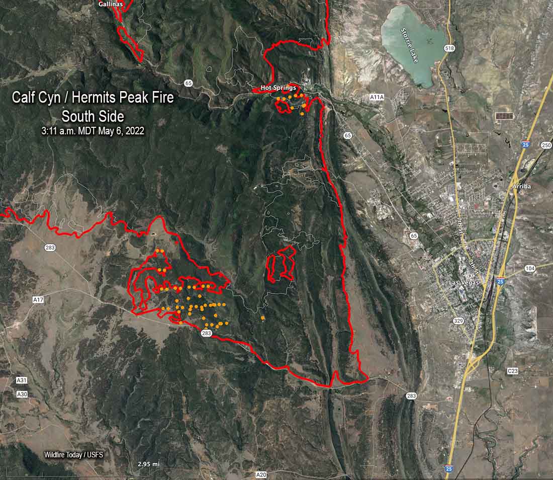 Map of the south side of the Calf Canyon / Hermits Peak Fire. The red line was the perimeter at 10:15 p.m. May 5. The white line was the perimeter two days before. The brown dots represent heat detected by satellites during the 24-hour period ending at 3:11 a.m. MDT May 6, 2022.
Most of the growth of the Calf Canyon / Hermits Peak Fire on Wednesday and Thursday was in three areas, on the north side west of Mora, on the southwest side near Bear Mountain, and the southeast side west of Las Vegas. Most of the additional acres near Las Vegas were a result of large burning operations conducted by firefighters to secure the fire edge. A mapping flight Thursday night determined that the fire had burned 168,009 acres, an increase of about 8,000 acres over the previous two days.
An area that is of concern to many residents in the area, the portion of the fire near Las Vegas, is “looking awesome”, said Operations Section Chief Todd Abel in a Friday morning briefing, implying there was not much active fire and the control lines are in place and holding.
Mr. Able said the weather and fire conditions have allowed firefighters to build direct fireline on the north side just west of the community of Cleveland, which is good news with strong winds in the forecast (see below for more weather information).
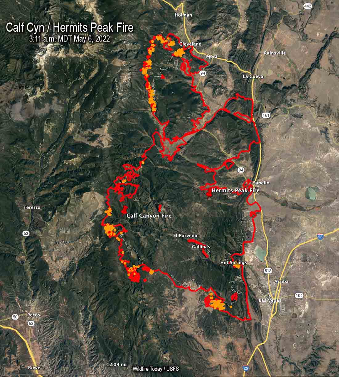 Map of the Calf Canyon / Hermits Peak Fire. The red line was the perimeter at 10:15 p.m. May 5. The white line was the perimeter two days before. The red and brown dots represent heat detected by satellites as late as 3:11 a.m. MDT May 6, 2022.
The weather is going to be a challenge again this weekend due to what firefighters call a “wind event”. According to the forecast Saturday will bring strong winds gusting to 39 mph, becoming even stronger on Sunday and Monday gusting to 45 mph. The direction will be generally out of the southwest and west while the minimum relative humidity each day hovers around 10 percent. These conditions will test the firelines on the east and northeast sides of the blaze. Firefighters, of course, are aware of the prediction and have been prepping structures, constructing and improving firelines, and building contingency lines further out.
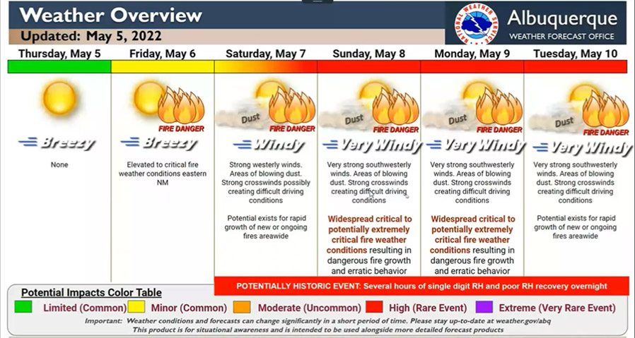
A multi-day critical fire weather event will impact mainly New Mexico through the next few days, and also much of SE Colorado, eastern Arizona and the Texas panhandle/west TX. A combination of strong winds, low humidity, & warm temperatures can contribute to extreme fire behavior pic.twitter.com/u2mhxpK5FU
— National Weather Service (@NWS) May 6, 2022
Over the last few days fire crews have been working north of the fire to be prepared if the fire makes a big run in that direction toward Chacon and Guadalupita South along the 519, 121, and 434 roads. Northeast and southeast of Mora they have used dozers to build firelines behind homes.
The Southwest Team #2 is bringing in a second team, a Type 2 team, Southwest Team #3. As explained by Operations Section Chief Todd Abel Friday morning, “They will integrate with our team. This means there’s still just one team, but we brought those people in to help us have a little bit more capacity so that if we have the potential to move further north that we have those folks available.”
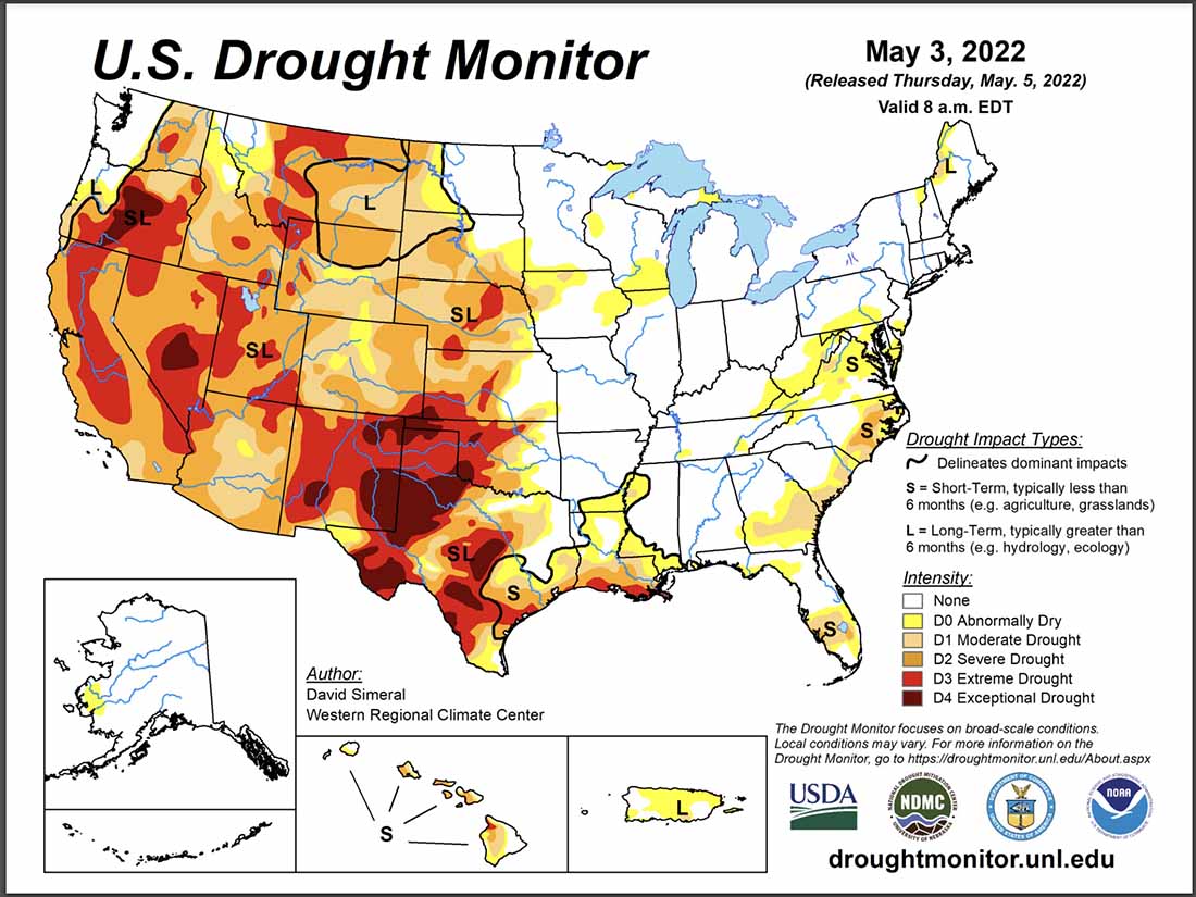
Most of New Mexico is in extreme or exceptional drought. The vegetation, or fuels, are atypically dry due to the drought, exacerbated by strong winds and high temperatures. Extremely dry fuels is one of the factors that can contribute to the rapid spread of a fire, especially when combined with very low humidity, high temperatures, and very strong winds.
The spread of the Calf Canyon / Hermits Peak Fire has been primarily through Ponderosa pine with a significant amount of dead and downed fuels in the understory. As the fire progresses downslope to the east, the dominant fuels transition through pinyon/juniper, Gambel oak, and brush to short grass.
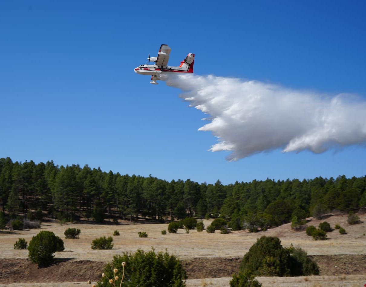 CL-415 scooping air tanker supports a firing operation on the Calf Canyon & Hermits Peak Fire, New Mexico. May, 2022. IMT photo.





