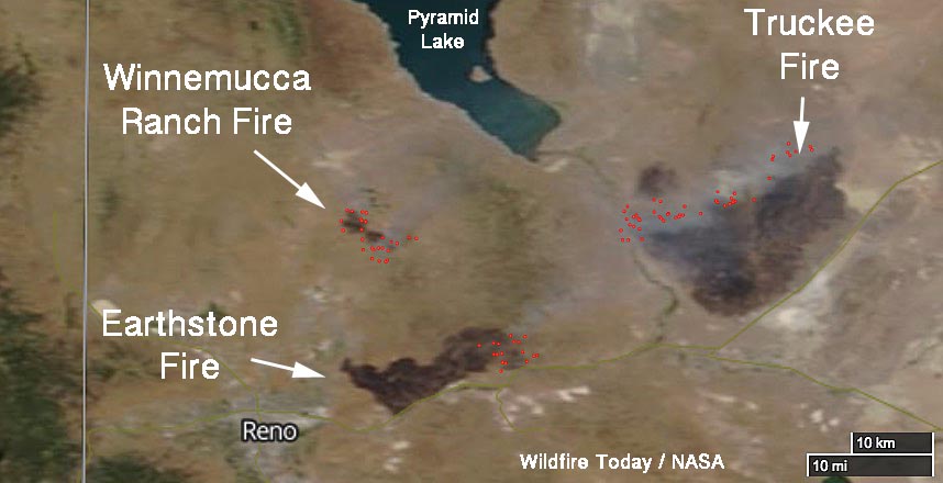
This satellite photo shows three wildfires near Reno, Nevada as seen by a satellite July 5, 2017 — the Earthstone, Truckee, and Winnemucca Ranch Fires. The burned areas appear very dark and the red dots represent heat.
More information about these fires.