

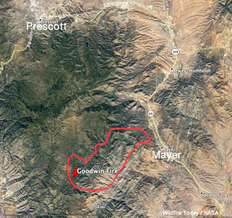
Above: The map shows the approximate location of the Goodwin Fire at 2:40 pm MDT, June 27, 2017. The data was supplied by a NOAA satellite and is a very rough estimate.
(UPDATED at 8:31 p.m. MDT June 27, 2017)
(Originally published at 5:57 p.m. MDT June 27, 2017)
The spread of the Goodwin Fire toward Highway 69 and Mayer, Arizona forced the mandatory evacuation Tuesday afternoon of the entire town and its 928 residents. The community of Pine Flat was previously evacuated.
According to satellite data we acquired at 2:40 p.m. MDT on Tuesday, at that time the Goodwin Fire was 12 miles southeast of Prescott, 1 mile west of Mayer, and 6 miles southwest of Dewey-Humboldt. According to the data, the fire has burned approximately 13,000 acres — that is a VERY unofficial estimate, three times the size determined by an infrared mapping flight Monday night, which was 4,400 acres. Consider the 13,000 acre figure preliminary and a very rough estimate until the next mapping flight Tuesday night.
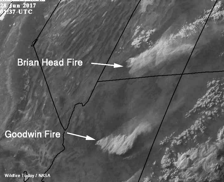
On Tuesday afternoon the fire was driven by southwest to southeast winds of 8 to 15 mph with gusts up to 22 mph. A weather station at Spring Valley southeast of the fire Tuesday afternoon recorded 95 degrees and a relative humidity of 6 percent.

The fire started three days ago on June 24 and is being managed by John Pierson’s Type 1 Incident Management Team.
Diane Souder, a spokesperson for the fire, said Tuesday at 5:50 p.m. MDT resources working on the fire included 2 air tankers, 4 helicopters, 29 engines, and 525 personnel.
This is what crews are battling near SR 69. SR CLOSED btwn I-17 and SR 169 to all traffic. Use SR 169 and SR 89. #GoodwinFire pic.twitter.com/G4u2vGMZlr
— Arizona DOT (@ArizonaDOT) June 28, 2017
Hundreds of firefighters are battling a growing wildfire near Prescott, Arizona. The blaze is only 5% contained. https://t.co/fhintfn3P2 pic.twitter.com/85ELyk5wgF
— CBS Evening News (@CBSEveningNews) June 27, 2017
Thanks and a tip of the hat go out to Tom.
Typos or errors, report them HERE.


