


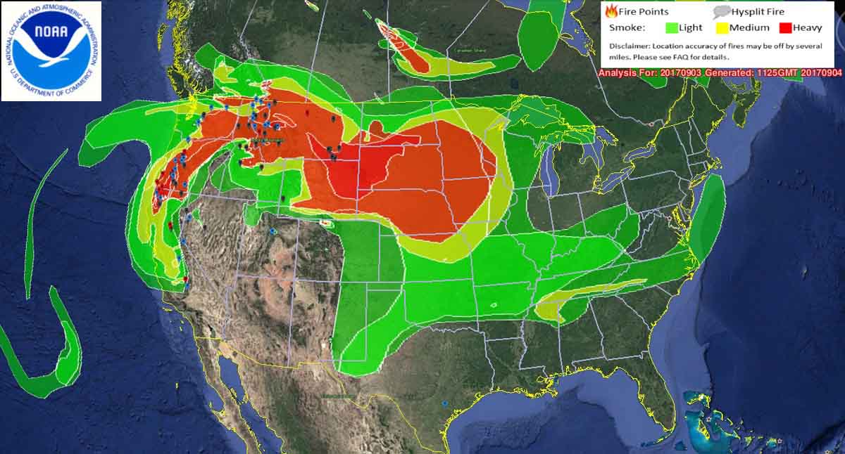
Above: Wildfire smoke map, 5:24 a.m. MDT September 4, 2017. The icons represent the locations of some of the large uncontained wildfires.
(Originally published at 10:50 a.m. MDT September 4, 2017)
The smoke from wildfires in Montana, Idaho, and the northwest United States is producing worsening conditions in the northwest and northcentral United States.
The locations that NOAA classified as having “heavy” smoke concentrations at 5:25 a.m. Monday included areas in California, Oregon, Washington, Idaho, Montana, North Dakota, South Dakota, Wyoming, Nebraska, Minnesota, Iowa and Kansas.
According to the National Interagency Coordination Center, there are 58 large uncontrolled fires, but that does not count the 29 fires being managed under a less than full suppression strategy. NICC says to date 7.6 million acres have burned, compared to the 10-year average of 5.4 million acres.


