


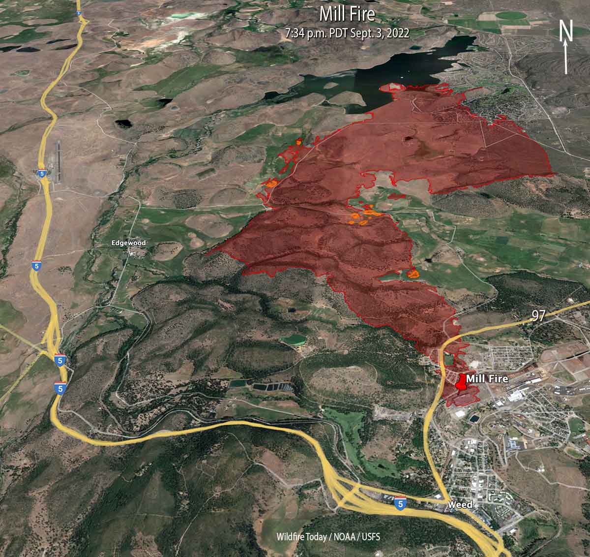
 Mill Fire 3-D map, looking north at 7:34 p.m. PDT Sept. 3, 2022. The small orange areas represent intense heat.
Two wildfires in Northern California, the Mill and Mountain Fires, have burned a total of more than 10,000 acres in and near the town of Weed 56 air miles north of Redding. Both fires are being suppressed by CAL FIRE’s Incident Management Team 5.
Mill Fire
The fire is believed to have started near a lumber mill where it destroyed a commercial building and spread very rapidly through a portion of the town of Weed. It continued for another five miles to the north until it reached Lake Shastina.
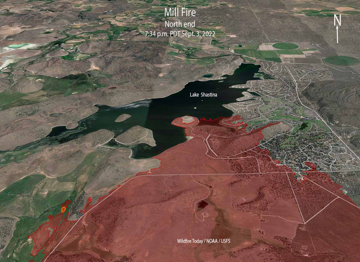 Map of the north end of the Mill Fire, looking north at 7:34 p.m. PDT Sept. 3, 2022. The small orange areas represent intense heat.
Initially working with aerial imagery, officials determined that 132 structures had been affected. Damage assessment teams began ground truthing the information on Sunday. The initial early estimates from the Mayor of Weed and a CAL FIRE Unit Chief were that 100 homes were destroyed.
Evacuation orders and warnings are still in place but officials are repopulating areas where safely possible. A map is at Zonehaven.
Additional growth of the Mill Fire on Saturday was minimal. It was mapped Saturday evening at 4,254 acres.
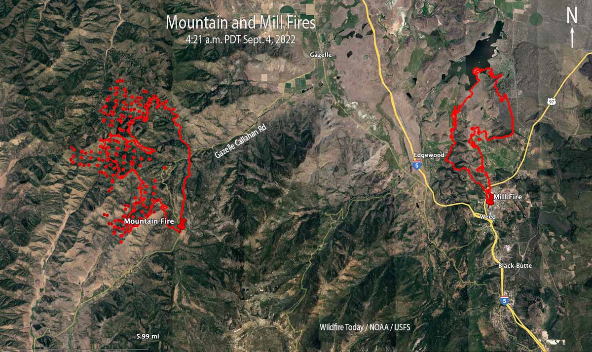 Map of the Mountain and Mill Fires. The red dots represent heat detected by satellites at 4:21 a.m. PDT Sept. 4, 2022. The red lines were the perimeters at about 7:40 p.m. Sept. 3, 2022.
Mountain Fire
About 12 miles west of Weed the Mountain Fire had burned 6,451 acres when it was mapped Saturday evening, but it continued to spread into the night to the north and west. There have been no reports of destroyed structures and 685 remain threatened. Approximately 332 people have been evacuated.
Evacuations are in effect. A map is at Zonehaven.
The fire is very different from the Mill Fire. There are fewer structures close to where it is presently burning, it is in remote, rugged terrain, and there is little road access. Fire behavior in the last 48 hours has been described as extreme, with hazardous trees, snags, strong gusty winds, and high temperatures. The area ranges from 2,700′ to 6,000′ elevation. On September 2 a Fuels and Fire Behavior advisory was issued for Northern California due to extreme drought, extremely dry fuels, and extended periods of hot weather. It warned that fire behavior would be elevated for the near future.
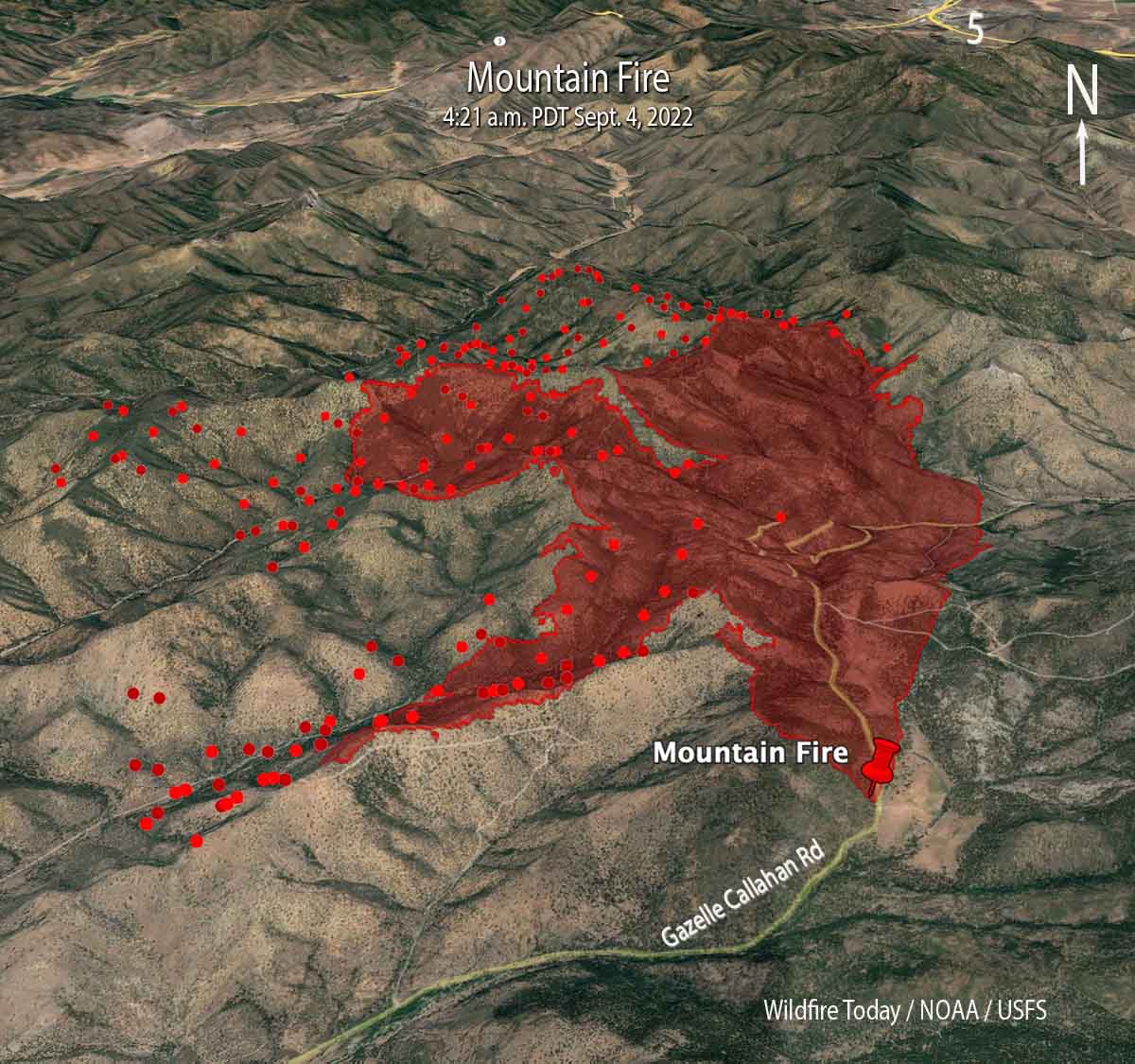 Mountain Fire 3-D map looking north. The red dots represent heat detected by a satellite at 4:21 a.m. PDT Sept 4, 2022. The red line was the perimeter at about 7:40 p.m. Sept. 3, 2022.
There is no nearby significant recorded history of fire in the National Interagency Fire Center database. However that database is often lacking complete information. The fire has the potential for growth in all directions, including through numerous clear cuts with dry, light to medium flashy fuel.
Threatened communities include Gazelle and Scott Valley.





