


9:10 p.m. PDT July 22, 2021

On Tuesday the Tamarack Fire burned from California into Nevada, and Thursday afternoon it made another big push to the east and hit US Highway 395 with some intensity north of Holbrook Junction. At first it was just a spot fire across the road but it grew very rapidly and at 4:10 p.m. aerial firefighters estimated it had burned 2,500 acres east of the highway.
Several large air tankers including a DC-10 Very Large Air Tanker assisted firefighters on the ground in an attempt to stop the spread of slopover across the highway.


The Incident Management Team has created an interactive map that at some point is supposed to have evacuation information for residents.
2:32 p.m. July 21, 2021

The Incident Management Team that is suppressing the Tamarack Fire posted on InciWeb their view about how the fire was managed during the first 12 days after it started. The statement was presumably approved by the U.S. Forest Service, the jurisdiction responsible for suppressing and/or managing the fire which was on the Humboldt-Toiyabe National Forest.
“The Tamarack Fire on the Humboldt-Toiyabe National Forest was discovered on July 4,” the statement says. “At the time, 23 other lightning fires were burning. It was a single tree burning in the Mokelumne Wilderness on a rocky ridgetop with sparse fuels and natural barriers to contain it. The steep, rugged, and remote terrain presented challenges to safely suppress this wilderness fire. With several higher priority fires in the area and due to the remote location, the sparse fuels and natural barriers, and the concern for firefighter safety, the decision was made to monitor the Tamarack Fire.”
“The Tamarack Fire was monitored daily via air and fire cameras and exhibited very little fire behavior until Friday, July 16 when fueled by extreme winds and low humidity, it progressed rapidly downslope and spread throughout the evening. With this rapid change in the fire, fire resources were dispatched on Friday, July 16. Additional firefighting resources were also ordered, including very Large Air Tankers (VLAT), Single Engine Airtankers (SEATS) and helicopters.”
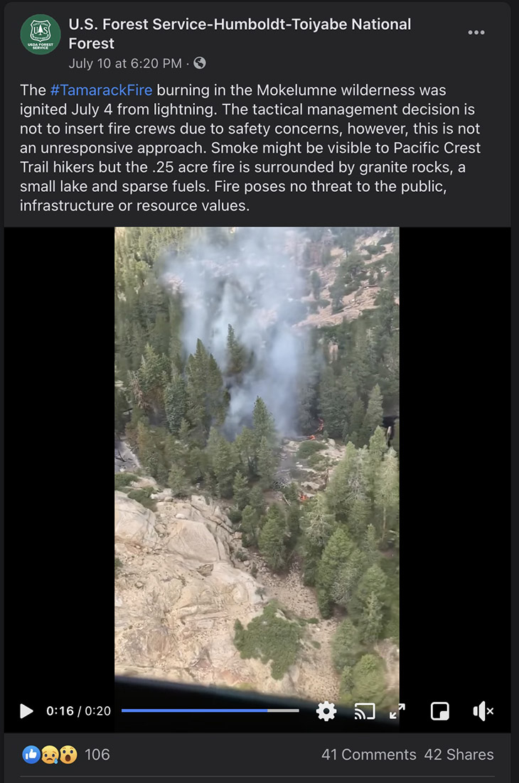
Below is a still image of a Forest Service Facebook post with a video of the fire when it was a quarter acre on July 10, six days after it started. “Fire poses no threat to the public, infrastructure, or resource values,” they wrote.
The Tamarack Fire spread further east on Tuesday, crossing the state line from California into Nevada. From its origin, it has now spread 15 miles northeast and 10 miles to the north, burning 10 structures and approximately 40,000 acres.
To see all articles on Wildfire Today about the Tamarack Fire, including the most recent, click HERE.


