


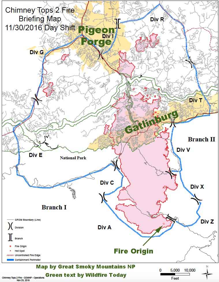
As far as we know this is the first publicly available map of the Chimney Tops 2 Fire that burned from Great Smoky Mountains National Park into Gatlinburg and Pigeon Forge, Tennessee. The incident management team reports it has burned 15,653 acres.
We are not aware of an official estimate of the number of structures destroyed in the fire since Tuesday morning’s report from the Tennessee Emergency Management Agency (TEMA) of approximately 100 homes in Sevier County Tennessee having been either damaged or destroyed.
WBIR has a list of areas affected by the fire with brief descriptions of the damage. From that information it appears that the number of structures destroyed will be much larger than the early estimate.
On Wednesday a Type 1 Incident Management Team run by Mike Dueitt assumed command of the Chimney Tops 2 Fire. Teams like this are made up of federal and state interagency team members from across the country who collaboratively manage wildland fires and other natural disasters.
The evacuation of Pigeon Forge has been lifted but is still in effect for Gatlinburg.
Firefighters will be aided on Wednesday by rain. The NWS predicts a 73 to 100 percent chance of precipitation into the evening with accumulations of about a third of an inch.
For the most current information about the Chimney Tops 2 Fire at Gatlinburg, see our articles tagged “Chimney 2 Fire”.


