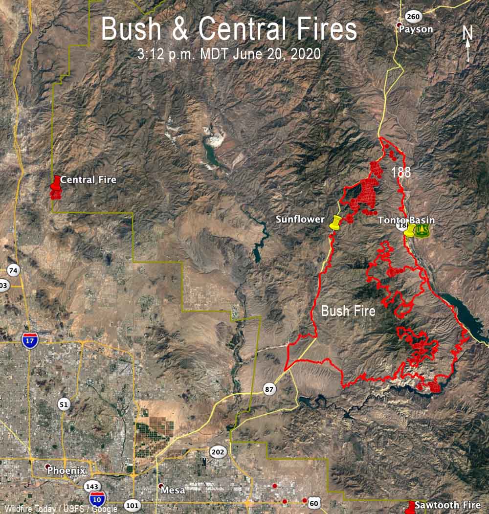
The Central and Bush Fires in the Phoenix Area, June 21, 2020.
(UPDATED at 10:52 a.m. MDT June 20,2020)
Friday night’s mapping flight determined that the Bush Fire had burned 174,397 acres, an increase of 23,397 acres in 24 hours.
For all articles on Wildfire Today about the Bush Fire northeast of Phoenix including the most recent, click here.
(UPDATED at 8:23 a.m. MDT June 19, 2020)
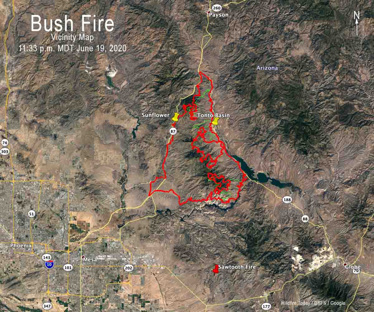
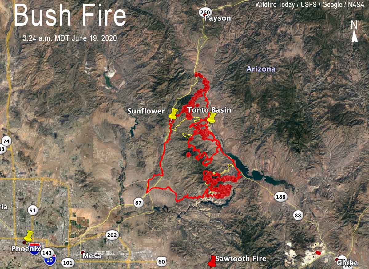
The red line was the perimeter of the Bush Fire detected by a mapping flight at 11:18 p.m. MDT June 18. The yellow line was the perimeter detected by a mapping flight at 11:49 p.m. MDT June 17. The red dots represent heat detected by a satellite at 3:24 a.m. MDT June 19.
The fire has grown to 151,075 acres.
(UPDATED at 8:04 p.m. MDT June 18, 2020)
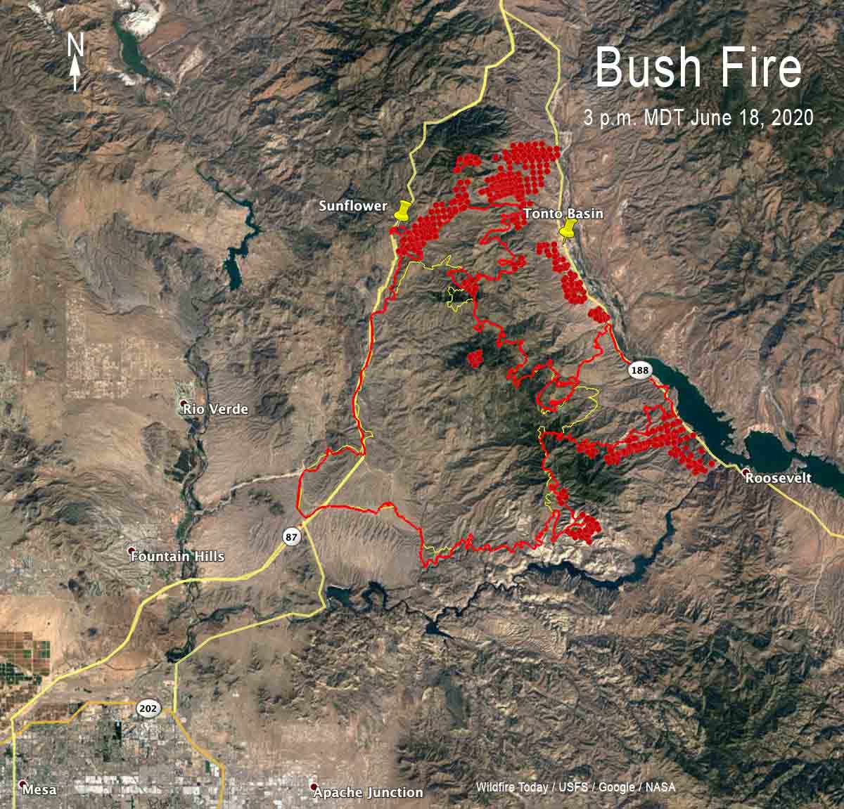
The red line was the perimeter of the Bush Fire detected by a mapping flight at 11:49 p.m. MDT June 17. The yellow line was the perimeter detected by a mapping flight at 11:12 p.m. MDT June 16. The red dots represent heat detected by a satellite at 3 p.m. MDT June 18.
(UPDATED at 7:42 a.m. MDT June 18, 2020)
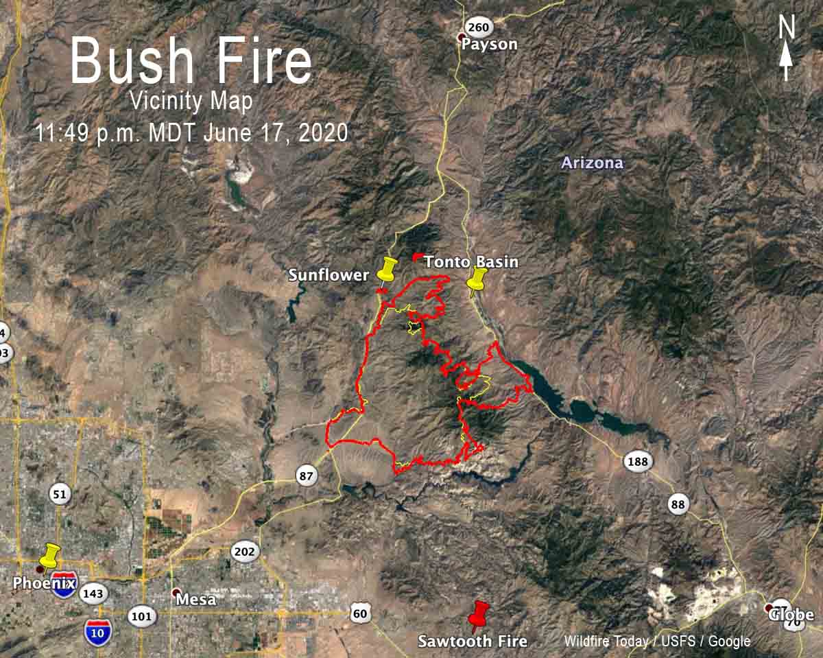
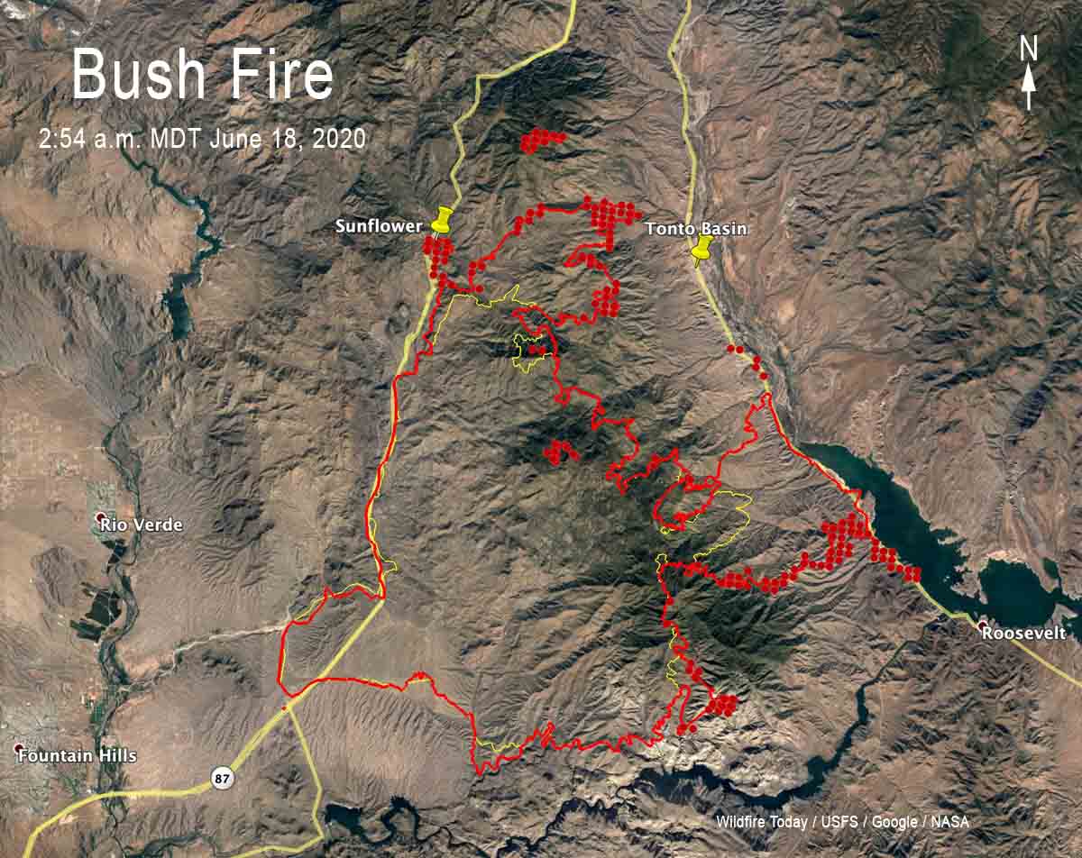
Vicinity map for the Bush Fire, 11:49 p.m. MDT June 17, 2020. The red line was the perimeter of the Bush Fire detected by a mapping flight at 11:49 p.m. MDT June 17. The yellow line was the perimeter detected by a mapping flight at 11:12 p.m. MDT June 16. The red dots represent heat detected by a satellite at 2:54 a.m. MDT June 18.
For all articles on Wildfire Today about the Bush Fire northeast of Phoenix including the most recent, click here.
(UPDATED at 7:25 p.m. MDT June 17, 2020)
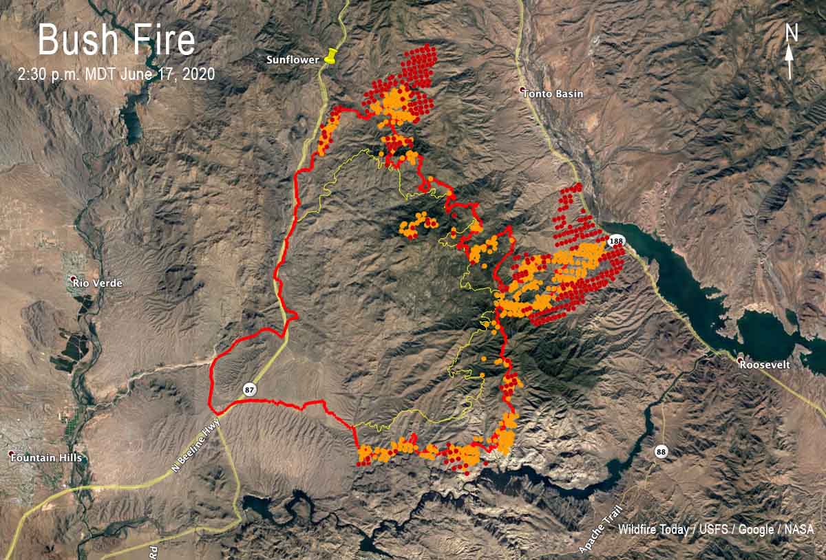
The red line was the perimeter of the Bush Fire detected by a mapping flight at 11:12 p.m. MDT June 16. The yellow line was the perimeter detected by a mapping flight at 12:45 a.m. MDT June 16. The orange and red dots represent heat detected by a satellite on June 17.
(UPDATED at 9:20 a.m. MDT June 17, 2020)
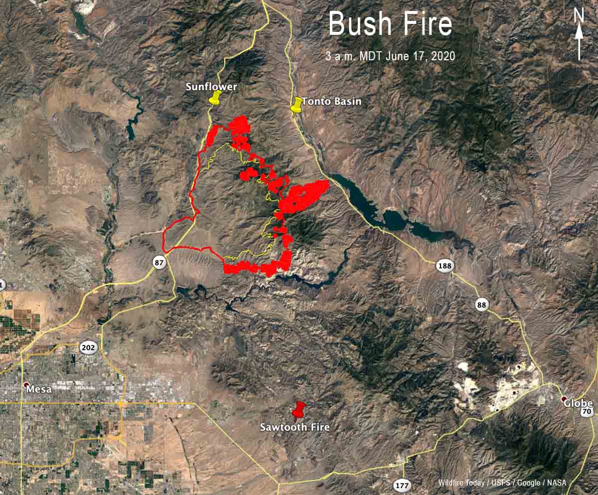
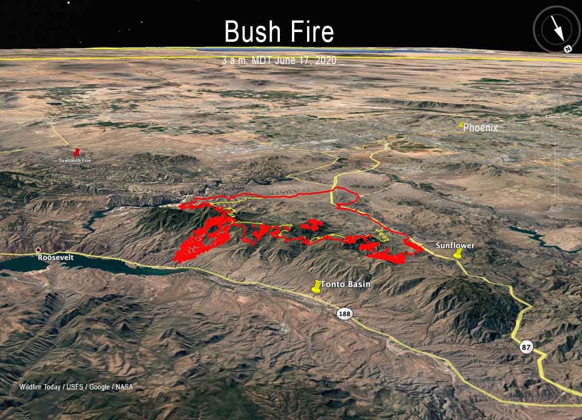
Map of the Bush Fire at 3 a.m. MDT June 17, 2020. Data from USFS mapping flight and NASA satellites. 3-D map of the Bush Fire at 3 a.m. MDT June 17, 2020. Data from USFS mapping flight and NASA satellites.
For all articles on Wildfire Today about the Bush Fire northeast of Phoenix including the most recent, click here.
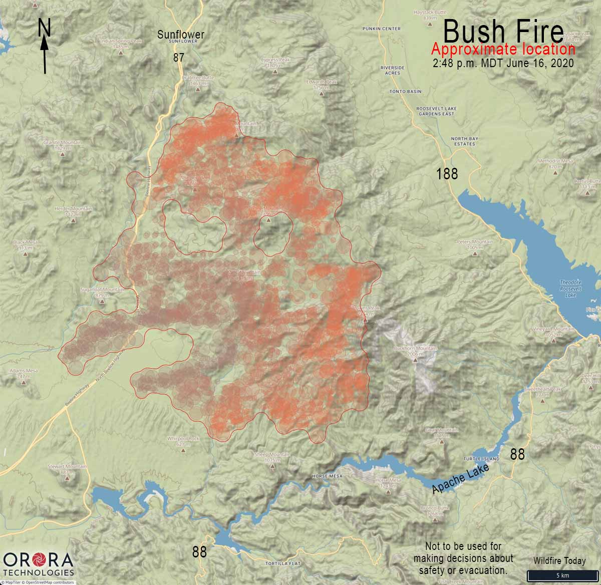
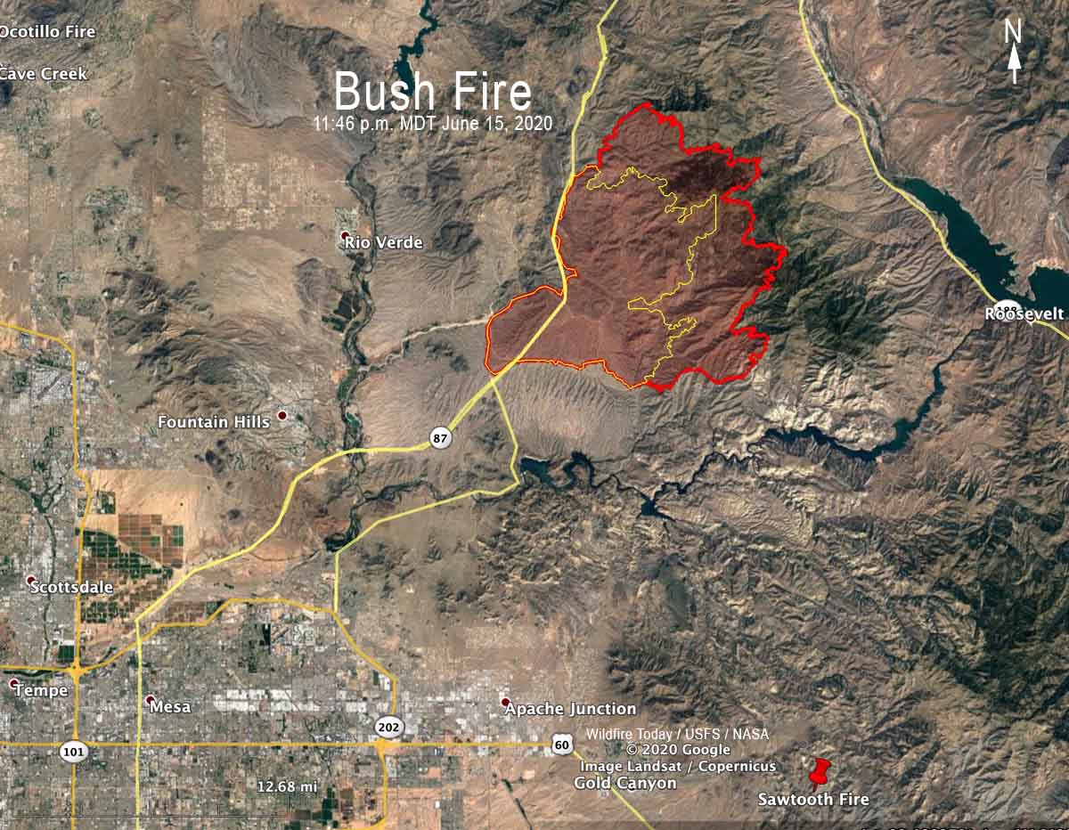
Map showing the approximate location of the Bush Fire at 2:28 p.m. MDT June 16, 2020. It is based on heat detected by satellites. This unofficial map should not be used to make decisions about safety or evacuation. Map showing the approximate location of the north side of the Bush Fire at 12:50 pm MDT June 16, 2020. 3-D map showing the perimeter (in red) of the Bush Fire looking northeast at 11:46 p.m. MDT June 15, 2020. The yellow line was the perimeter 24 hours before. Map showing the perimeter of the Bush Fire (in red) at 11:46 p.m. MDT June 15, 2020. The yellow line was the perimeter 24 hours before.
A mapping flight Monday night at 11:46 determined that the Bush Fire had burned 64,513 acres.
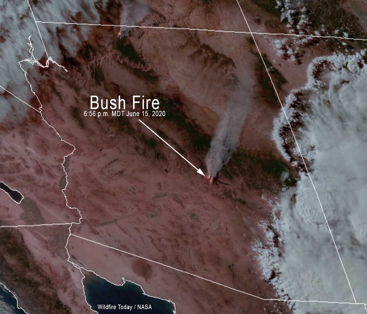
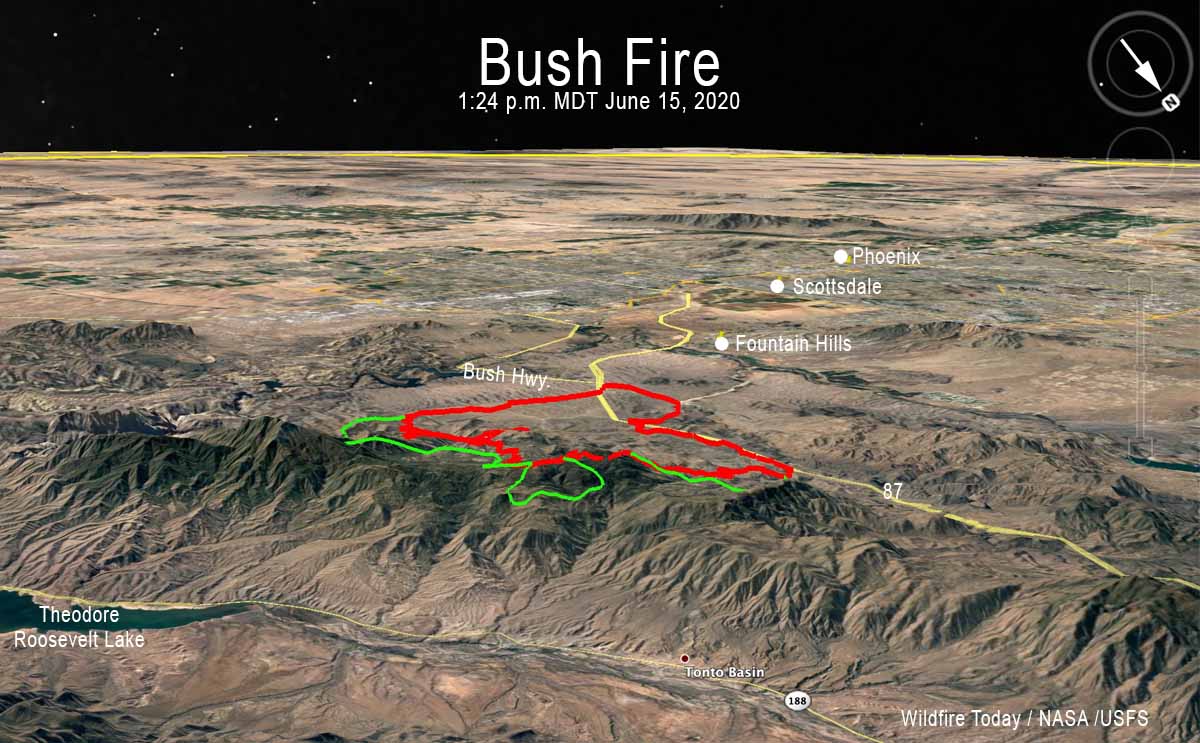
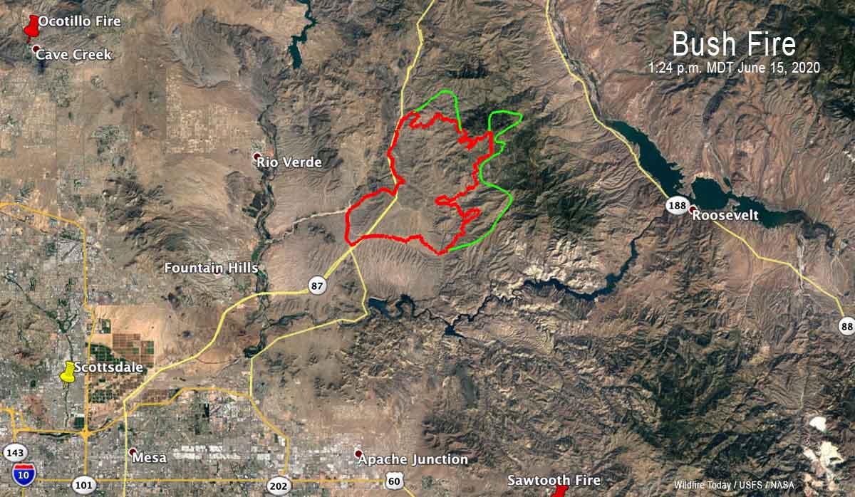
GOES-17 satellite photo of the Bush Fire northeast of Phoenix at 6:56 p.m. MDT June 15, 2020. 3-D Map of the Bush Fire northeast of Phoenix looking southwest. The red line was the perimeter at 11:25 p.m. MDT June 14, 2020. The green line was the additional growth through 1:24 pm MDT June 15, 2020. Map of the Bush Fire northeast of Phoenix. The red line was the perimeter at 11:25 p.m. MDT June 14, 2020. The green line was the additional growth through 1:24 pm MDT June 15, 2020.