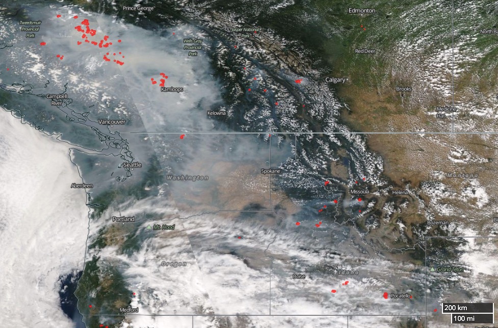
Above: Satellite photo showing wildfire smoke in the northwestern United States and British Columbia August 6, 2017. The red dots represent heat.


Above: Satellite photo showing wildfire smoke in the northwestern United States and British Columbia August 6, 2017. The red dots represent heat.


