


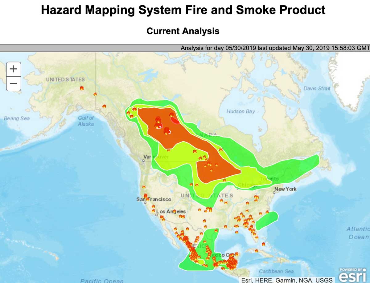

Here is how the NOAA Office of Satellite And Product Operations described the smoke conditions at 10:36 a.m. MDT May 30, 2019:
“Northwestern to Western Canada/South Central Canada/Southeastern
Canada/Northern New England…
“Large complex wildfires are continuing to burn and be observed over Northern Alberta Province and through portions of Northwestern Canada. Several smaller fires are burning and being observed as well in South Central Canada. Heavy density smoke is being observed in the region of the large complex wildfires and has been transported with the low level flow South and Eastward down into South Central Canada, into North and South Dakota, and into the Northern Upper Midwest Region. Moderate density smoke is being observed throughout most of Alberta Province, Northwestern Canada, South Central Canada, the High Plains, the Midwest, Ontario, and into Upstate New York. Light density smoke has been observed throughout most of Northwestern Canada, South Central Canada, the Plains, Midwest, the Southern Great Lakes region, Northern New England and progressing into far Southeastern Canada. The smoke is expected to continue to progress South and East over the day.”


