


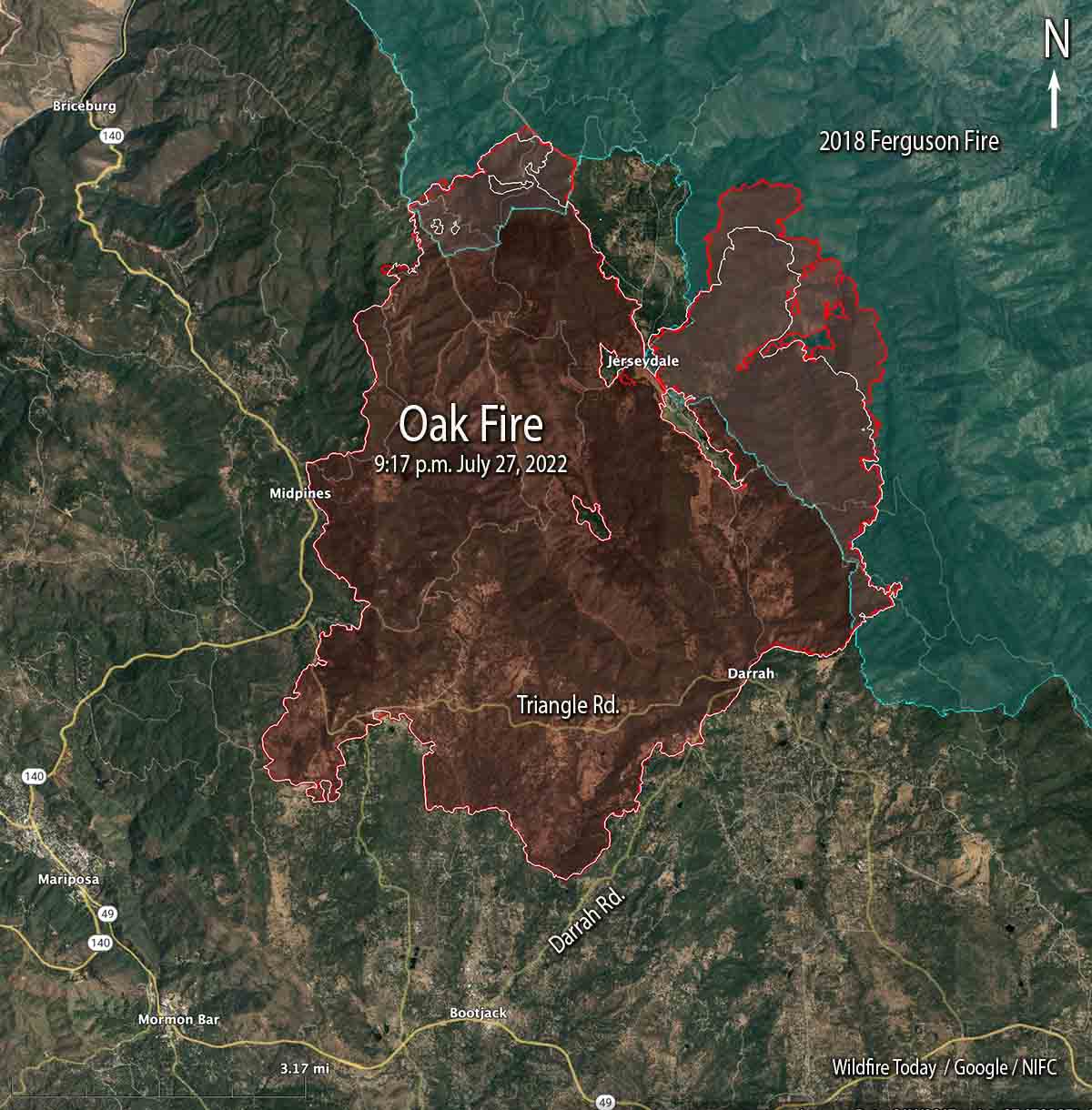
 Oak Fire map. The red line was the perimeter at 9:17 p.m. July 27, 2022. The white line was the perimeter about 48 hours before.
Most of the perimeter of the Oak Fire northeast of Mariposa, California was quiet on Wednesday, with the exception of the north and northeast sides where it has continued to spread. Firefighters have constructed firelines in those areas, some of them indirect, and are making progress. It has moved one to two miles into the footprint of the 2018 Ferguson Fire.
To see all articles on Wildfire Today about the Oak Fire, including the most recent, click HERE.
The fire was mapped Wednesday night at 19,169 acres.
The video below was shot by the FIRIS aircraft looking south at the northeast side of the fire at 9:20 p.m. July 27. White indicates heat.
OES Intel 12, July 27th on the #OakFire MMU. Fire is mapped at 19,169 acres at 21:20 hours. Video # 1 of 2 pic.twitter.com/H5rRpADzWK
— FIRIS (@FIRIS) July 28, 2022





