

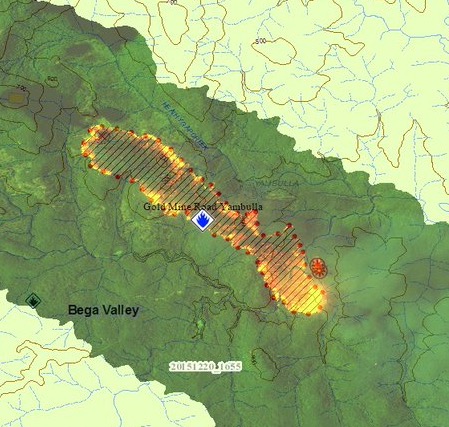
The image above was distributed by the New South Wales Rural Fire Service, showing a map of the Gold Mine Road Fire 17 km southwest of Towamba in the Yambulla State Forest. The map is part of the agency’s Common Operating Picture.
It was apparently obtained by infrared equipment that processed the data in a format we have not seen publicly in the United States. The black lines are most likely the path of the line scanner as the mirror rotated at thousands of RPM in a fixed wing aircraft. It’s interesting that the target discrimination marks (TDMs) only appear at the ends of each line, rather than at every heat source. The intensity of the heat is represented by a range of orange and yellow colors.
The U.S. Forest Service has been mapping fires with infrared equipment for at least four decades, but the folks down under also have very advanced IR systems.


