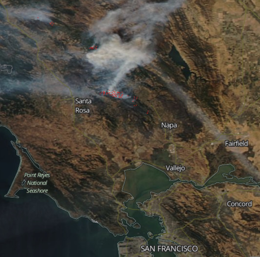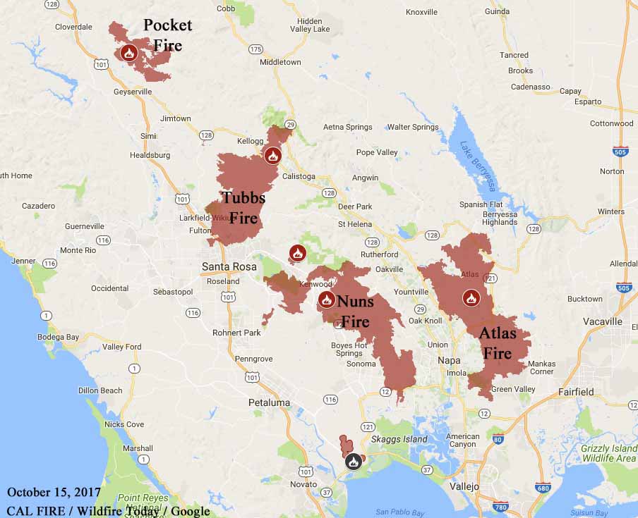
Above: Map showing the perimeters of the Pocket, Tubbs, Nuns, and Atlas Fires in northern California. CAL FIRE October 15, 2017.
(Published October 16, 2016)
Firefighters in Northern California are having some success on portions of the four largest wildfires near Geyserville, Santa Rosa, and Napa. However winds out of the southwest on Sunday caused the fires to spread on the northeast sides on all of the fires except the Atlas Fire which has been much quieter than the other three for the last two days.
Officials say 102,000 residents were either evacuated or had no homes to return to Saturday and Sunday in Sonoma County. Some evacuations were lifted late Sunday. Less than 2,000 stayed in evacuation centers.
The fires in Sonoma and Napa counties have destroyed 3,947 structures. Approximately 4,230 personnel are fighting the blazes.
Officials report that 40 people have been confirmed dead in Northern California fires over the last week including fires in Mendocino County and near Yuba City.
- Pocket Fire: 11,889 acres north of Geyserville. It continues to grow to the east and northeast.
- Tubbs Fire, 44,481 acres. The most active area of the fire is still the northeastern portion around Red Hill and Mount Saint Helena. It continues to make short uphill runs on the north side of the peaks.
- Nuns Fire, 48,627 acres. The northern portion 6 miles north of Calistoga grew to the north Sunday.
- Atlas Fire, 51, 057 acres. It is much quieter than the other three fires.

The National Weather Service predicts hot and dry conditions for the Santa Rosa area Monday with a high of 88 degrees, relative humidity in the mid-teens, and west or southwest winds of 2 to 9 mph.
Tuesday should bring better conditions for firefighters; 81 degrees, 28 percent RH, and southwest winds at 3 to 11 mph.