


Above: Photo of the Whittier Fire at 4:23 p.m. PDT July 8 2017. If you look in the lower left, you’ll see a DC-10 just beginning a retardant drop. Click to enlarge.
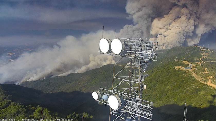
A web camera near Santa Ynez, California is taking some fascinating photos of the Whittier Fire that started at about 1:45 p.m. PDT Saturday near Camp Whittier on Hwy 154 near Lake Cachuma approximately seven miles east of Santa Ynez.
The fire is on the Los Padres National Forest. At 6:56 p.m. Saturday they estimated it had burned 330 acres.
Hwy 154 is closed from 246 to State Route 192.
The photos below were acquired around 6:20 p.m. PDT July 8. Click on them to see larger versions.


All of the articles we have written about the fire are tagged “Whittier Fire” and can be found here, with the most recent at the top.


