


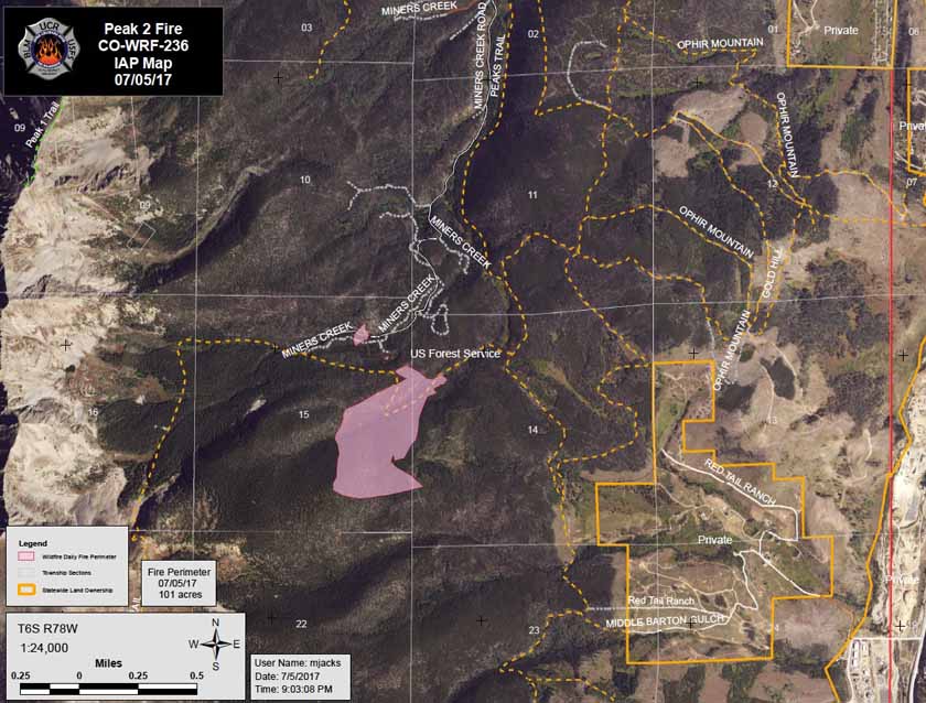
Above: Map of the Peak 2 Fire (shown in pink) created by the incident management team at 9:03 p.m. MDT July 5, 2017.
(Originally published at 7:55 a.m. MDT July 6, 2017)
The Peak 2 Fire two miles north of the ski runs at Breckenridge, Colorado slowed late Wednesday afternoon and at 7 a.m. Thursday showed very little vigorous fire activity.
At 7 p.m. Wednesday Colorado’s Multi Mission Aircraft mapped it at 84 acres.
Structures are threatened and evacuations are in effect for the Peak 7 housing development.
The photo below was posted at 6:41 a.m. Thursday by Carol McKinley.
A mile away from the #Peak2Fire shows smoke but few flames. Breckenridge is crossing its fingers for calm winds. pic.twitter.com/EO1v6K1umJ
— Carol McKinley (@CarolAMcKinley) July 6, 2017
The fire was reported at about 11 a.m. Wednesday near the ski resort 50 air miles west of Denver. Aircraft worked the fire that afternoon, along with eight Boise smokejumpers and a hotshot crew. Additional resources have been ordered.
At a media briefing Wednesday it was announced that a Type 1 Incident Management Team would arrive at the fire on Thursday.
The weather forecast for the fire area at 10,000 feet calls for 78 degrees, 26 percent relative humidity, and northwest winds of 8 mph gusting to 13.
The video below was shot Wednesday before the fire activity slowed late in the afternoon.
And below, another photo shot during the height of activity on the Peak 2 Fire near Breckenridge at 3 p.m.
#Peak2Fire yesterday 3:00 pic.twitter.com/dL5KToocTJ
— Geefer Man (@geefer) July 6, 2017


