Precipitation in the northwest one-quarter of the United States received over the last 72 hours will slow if not end the wildland fire season in some areas. The map shows precipitation detected by weather radar, which means there are gaps in areas with poor radar coverage.
According to the data, many areas received more than half an inch which will definitely have an effect lasting more than a few days.
You might notice that the rainfall in southeast Texas is completely off the chart, showing more than 15 inches. As this is written Thursday afternoon the Houston area is in the middle of the fifth 500+ year rainstorm in the last five years.
The Houston metro area is in the middle of one of the worst flash floods in American history, right now. This is at least the fifth 500+ year rainstorm in the region in just the past 5 years.
We are in a climate emergency. https://t.co/nV162bEAwX
— Eric Holthaus (@EricHolthaus) September 19, 2019
What has the weather been like in your area over the last week?
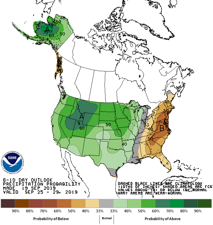
The maps below show the precipitation and temperature outlooks for September 25 through 29.