


Above: The Rice Ridge Fire. Image uploaded to InciWeb September 3, 2017. Uncredited.
(Originally published at 10:11 a.m. MDT September 4, 2017)
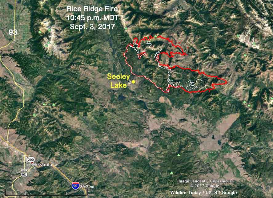
The Rice Ridge Fire just east of Seeley Lake, Montana, spread substantially Sunday, almost doubling in size. During a 10:45 mapping flight Sunday night, it was discovered that 48,531 acres had burned during the previous 24 hours bringing the total to 101,419 acres, achieving “megafire” status when it exceeded 100K acres. The blaze is 36 miles northeast of Missoula.
The west side of the fire near Seeley Lake did not change — the growth was on the north and east sides.
The key factors in the extreme fire behavior and spread on Sunday were the relative humidity and the wind. During the morning the wind was out of the south, which accounted for the growth on the north side. Then it slowly changed to be from the southwest and the west and by 9 p.m. was coming from the north.
The relative humidity just north of the community of Seeley Lake reached 8 percent Sunday, while the temperature maxed out at 88 degrees with 6 to 12 mph winds gusting at 14 to 18. The forecast for Monday calls for more moderate conditions — 78 degrees, east winds at 10-13, and 21 percent relative humidity.

The objective on the fire is not to put it out or contain it, but to herd it around as necessary to protect private property and structures. On Sunday 737 personnel were assigned to the fire which so far has run up costs of almost $30 million.
New MTN News map showing perimeter and growth of the #RiceRidgeFire after its 48k acre run Sunday. #MTfires pic.twitter.com/ghlEPD3jPt
— dennisbragg (@dennisbragg) September 4, 2017


