


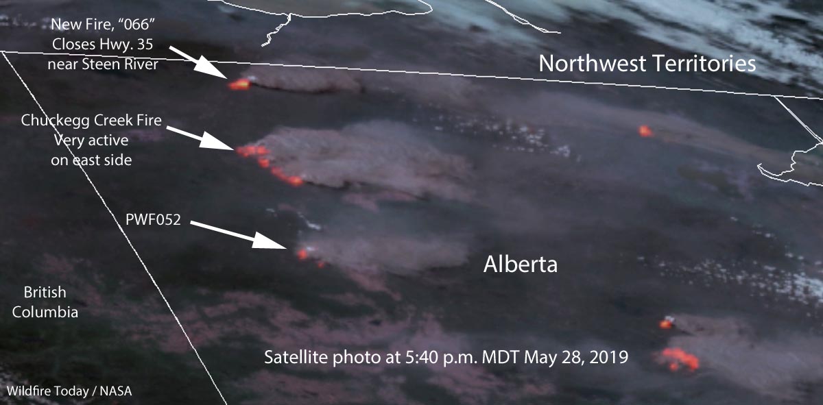
This satellite photo taken at 5:40 p.m. MDT April 28 shows the locations of three major wildfires in Northern Alberta. The imagery was enhanced to enhanced to show the heat generated by the active fires.
As predicted, the wind on Tuesday was out of the west which made the east sides of the fire more active than they had been in recent days. As you can see in the photo large amounts of smoke are flowing off to the east. Click here to see an analysis and map of wildfire smoke in North America today.
The northern-most fire identified on the map is a relatively new blaze, known as “066”. Alberta Wildfire said Tuesday afternoon, “[The fire] is approximately 6 km west of Highway 35 near Steen River. Highway 35 North of High Level is closed due to smoke – monitor Alberta511 for updated highway conditions.”
Update: Highway 35 CLOSED approximately 7 km north of Steen River, north of High level due to wildfire. Southbound traffic will be held in Enterprise – North West Territories and Northbound traffic will be held in High Level. (3:49pm) #ABRoads https://t.co/fPMAgLqR2A
— 511 Alberta (@511Alberta) May 28, 2019
The air quality in the town of High Level, Alberta has reached dangerous levels.
I have never seen levels like this for PM2.5. High Level AB is in serious trouble. pic.twitter.com/Vn2TUAlH3M
— Dr. Michael D Mehta (@MichaelMehta) May 28, 2019


