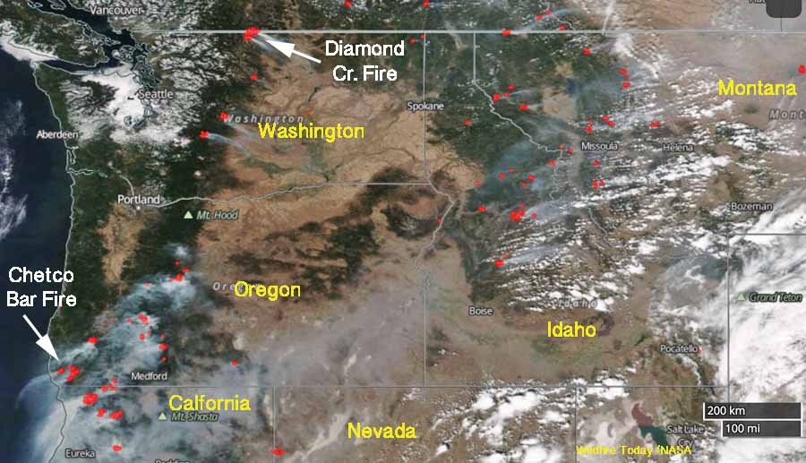
The satellite photo shows smoke from vegetation fires in the northwestern United States on August 31, 2017. The red dots represent heat detected by a satellite at 4:18 a.m. MDT September 1, 2017.
The satellite photo shows smoke from vegetation fires in the northwestern United States on August 31, 2017. The red dots represent heat detected by a satellite at 4:18 a.m. MDT September 1, 2017.