Skip to content

Smoke and air quality maps for September 17, 2020

September 17, 2020 | 7 a.m. PDT
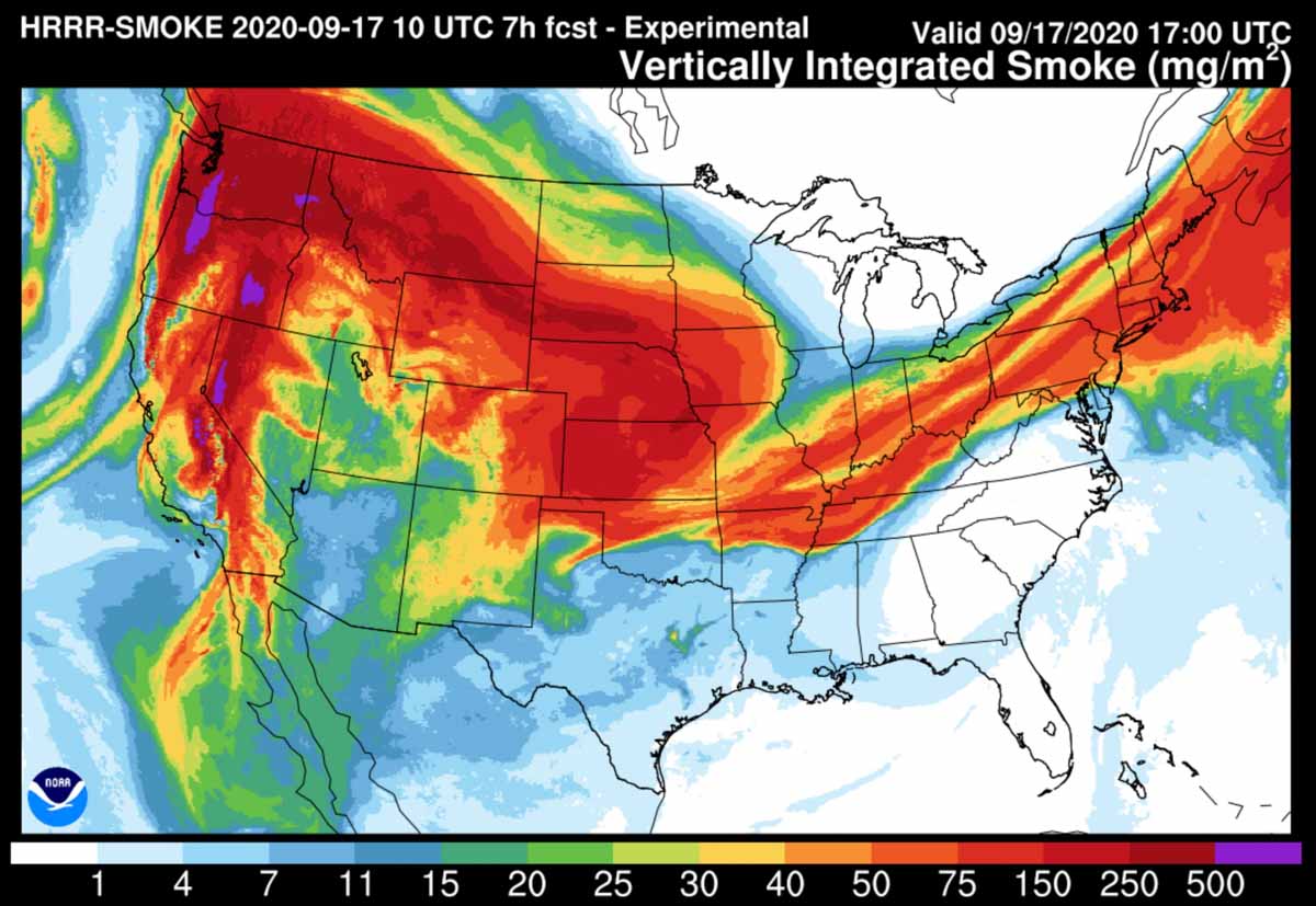
Forecast for vertically integrated smoke
Forecast map for vertically integrated smoke at 1 p.m. MDT Sept. 17, 2020

Near-surface smoke refers to the smoke that will hover within 8 meters (26 feet) of the ground—the kind responsible for burning eyes and aggravated asthma.

Vertically integrated smoke depicts all of the smoke in a vertical column, including smoke high in Earth’s atmosphere and can produce red sunrises and sunsets. In some cases where it is only at high altitudes it may not be very noticeable on the ground.

You can bookmark https://wildfiretoday.com/tag/smoke/ to always go to the latest article on Wildfire Today about smoke.

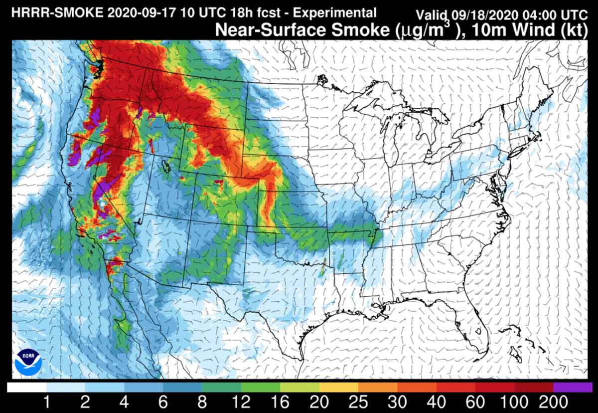
Forecast for near-surface smoke
Forecast map for near-surface smoke at 1 p.m. MDT Sept. 17, 2020
Forecast for near-surface smoke
Forecast map for near-surface smoke at 10 p.m. MDT Sept. 17, 2020.
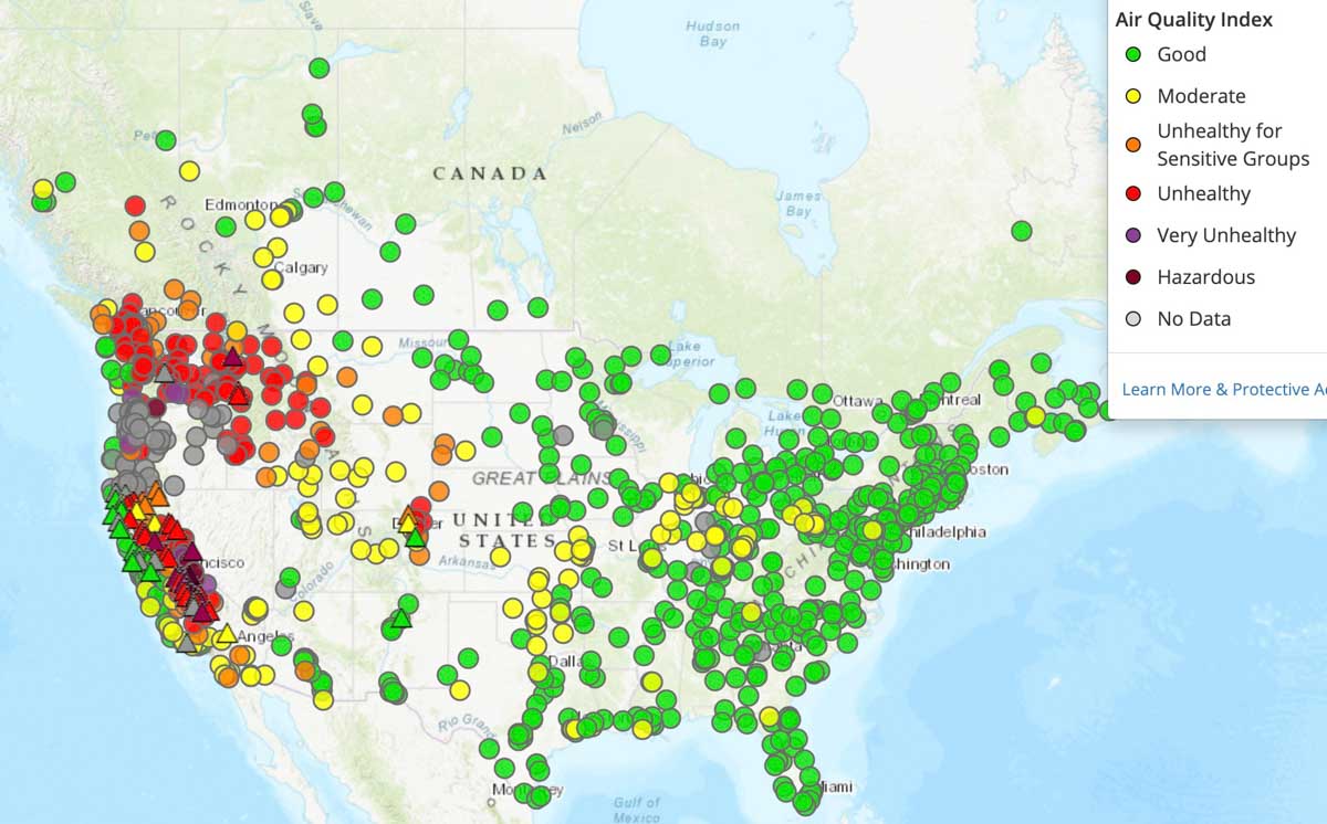
Air quality map 7:30 a.m. MDT September 17, 2020
Air quality map at 7:30 a.m. MDT September 17, 2020. AirNow.
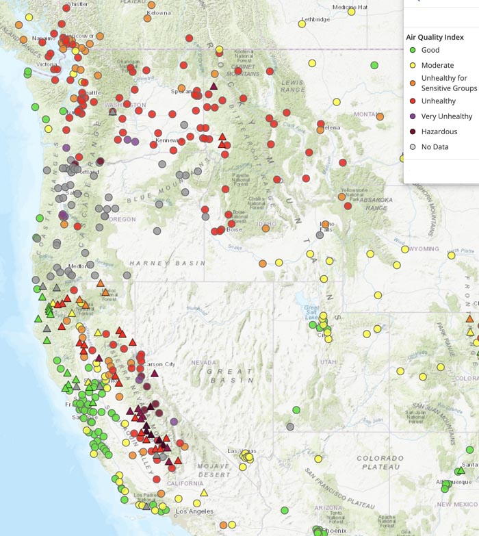
Air quality west coast
Air quality map at 7:30 a.m. MDT September 17, 2020. AirNow.

Comments

More in Reports