


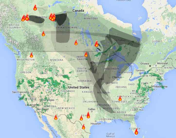
Smoke from the fires in Alberta, primarily the 210,000-acre blaze near Fort McMurray, is affecting Saskatchewan, Manitoba, the north-central United States, and many areas in the eastern U.S.
The map above was generated by NOAA at 12:20 p.m. MDT today. The light-colored areas represent the presence of wildfire smoke. The NOAA map below is from 3:45 a.m. MDT May 5.

The next map is from WeatherUnderground:
To see the most current smoke reports, visit the articles tagged “smoke” at https://wildfiretoday.com/tag/smoke/


