


(UPDATE at 5:23 p.m. PT, August 24, 2015)
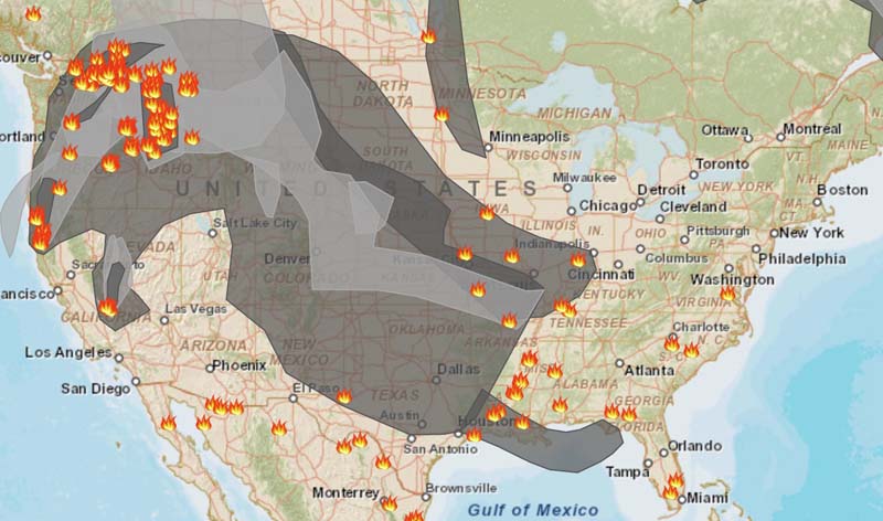
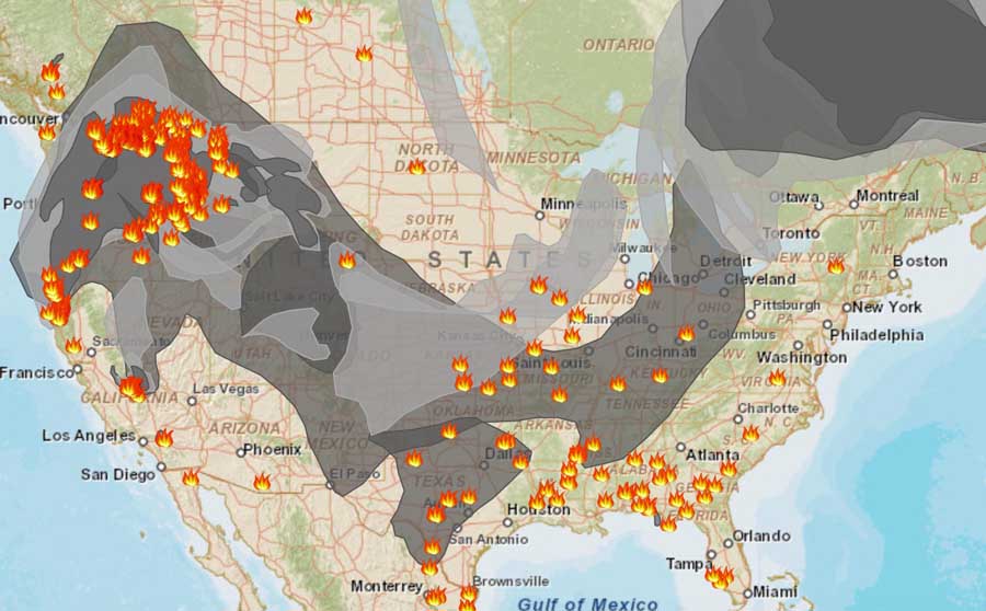
****
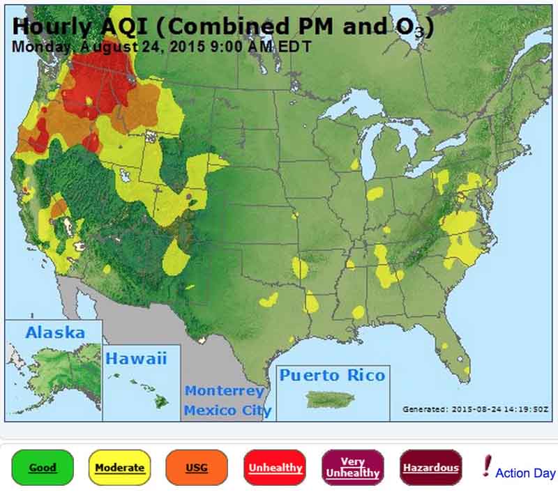
Areas in Washington, Oregon, Idaho, Montana, and California have “unhealthy” air quality, at least partially caused by smoke from wildfires.
The National Weather Service has issued Red Flag Warnings or Fire Weather Watches for areas in Washington, Oregon, Idaho, Montana, and California.
The map was current as of 8 a.m. MDT on Monday. Red Flag Warnings can change throughout the day as the National Weather Service offices around the country update and revise their forecasts and maps. For the most current data visit this NWS site or this NWS site.

To see the most current smoke reports on Wildfire Today, visit the articles tagged “smoke” at https://wildfiretoday.com/tag/smoke/







