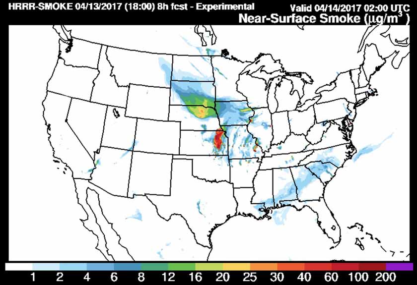
Residents in the Northern and Central Plains have been experiencing vegetation fire smoke today. Much of it has come from agricultural or prescribed burning in Missouri and the Flint Hills of Kansas. The map above, an experimental product from NOAA’s Earth Central Research Laboratory, shows the estimate of where the smoke would be at 8 p.m. MDT on April 13.
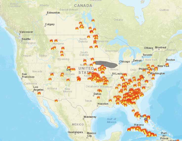
The map below shows the locations of fires, wild or prescribed, and AirNow’s estimate of a smoke plume.