


(UPDATED at 8 p.m. MDT July 2, 2018)
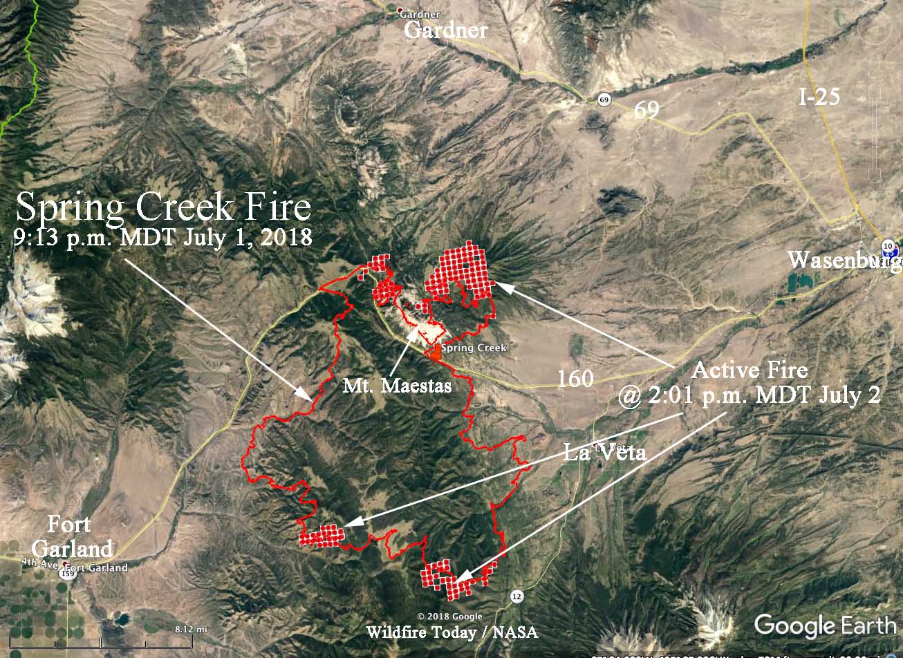
A brief update on the Spring Creek Fire burning 17 miles west of Walsenburg, Colorado. Monday afternoon at 2:01 a satellite detected active fire on the north side of Mt. Maestas. At that time the fire had not made it down to the flatter terrain on the north side but it may have by sundown. There was also activity on the southeast side during the satellite overflight.
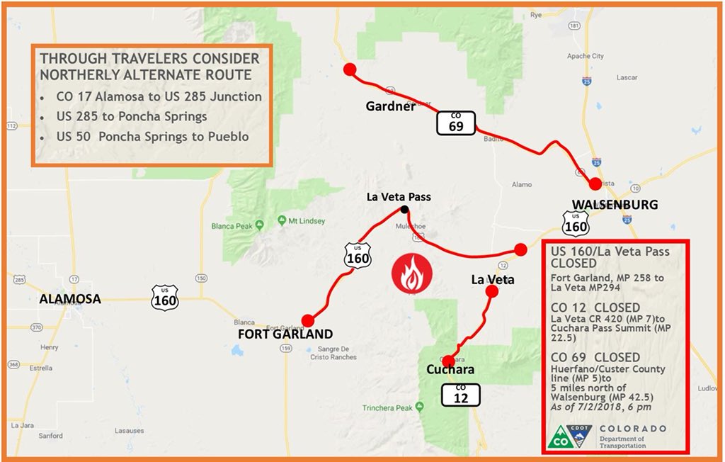
Portions of several highways are closed, including 69, 160, and 12.
(Updated at 12:27 p.m. MDT July 2, 2018)
On Sunday and Sunday night the Spring Creek Fire east of Fort Garland, Colorado spread closer to Highway 12, coming to within two miles in some places.
According to the Incident Management Team the fire has burned 56,820 acres with most of that being on private land. Approximately 2,878 structures are threatened but so far none have been destroyed.
Tuesday morning the management of the fire will be spilt with two Rocky Mountain Type 2 IMTs. The Blue Team will take the portion of the fire north of Highway 160.
CLICK HERE to see all of the articles on Wildfire Today about the Spring Creek Fire.
The IMT is concerned about outflow winds from passing thunderstorms Monday which could push the fire in any direction. The fire should become active before noon, and could be very active throughout the afternoon.
On the east side of the fire, growth has slowed somewhat as the fire moves into lighter fuels. Indirect contingency lines are being constructed, anchoring to the 421 road and Highway 12, with the goal of keeping the fire west of La Veta.
Below is more information from the IMT:
“On the south side in Division K, the fire has moved south of East Indian Creek and is progressing over the ridges of Raspberry Mountain, continuing downslope through heavy fuels. While this type of “backing” behavior (downhill growth), does not move as quickly as fire running up hill, the fire is expected to continue moving south/southwest toward Cuchara Village. The geography between Raspberry Mountain and the communities of Pinehaven and Cuchara Village is extremely challenging with significant beetle kill fuel, rough terrain and narrow canyons. This is a difficult area to place firefighters, as there are minimal escape routes should fire intensity change. As fire continues to push south, crews are constructing indirect line around the communities of Pinehaven and Cuchara Village and will prepare structures in this area in the event of fire spread. Expect to see large smoke columns in this area today.
“The fire is growing to the south-southwest in Divisions N and Z, pushing toward West Indian Creek. Crews are successfully implementing point protection for houses in the South Forbes community. Firefighters are scouting for opportunities to create indirect line to keep the fire north of West Indian Creek. On the southeast side of the fire, crews are working to construct fireline off Mallott Rd, moving from Division A south and east into Divisions Z and N to keep fire east of Trinchera.
“The west and northwest sides of the fire in Divisions A and D continue to hold. The 5% containment is along the northwest perimeter in Division D. Crews are scouting for options for more indirect line running from the ridges back into Highway 160.
“There is now a portable fire retardant plant east of La Veta. Aircraft will drop retardant on areas where its effects will be successful. Air tankers are in use, and the Spring Fire now has two National Guard Blackhawk helicopters participating in air operations along with currently assigned resources.”


