


Above: The Kincade Fire as seen from the St. Helena North camera at 9:06 a.m. PDT Oct. 27, 2019. Looking toward Healdsburg.
UPDATED at 5:53 p.m. PDT October 27, 2019
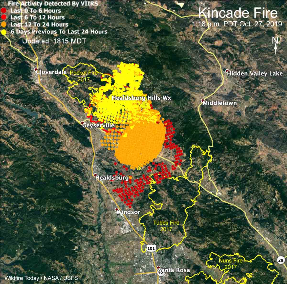
UPDATED at 12:30 p.m. PDT October 27, 2019
At a 10 a.m. press conference fire officials said they hope to stop the 30,000-acre Kincade Fire at the 101 freeway. The area west of the 101 does not have a recent history of fires so the vegetation, or fuel, is heavy and would present even more resistance to control.
After being closed and then open, the 101 is being closed again in the Healdsburg area between Arata Lane and Dry Creek.
Air attack, orbiting overhead and directing aircraft traffic on the Kincade Fire, has ordered large air tankers, hoping that they can be effective in spite of the near hurricane-force winds creating turbulence and possibly blowing retardant off target.
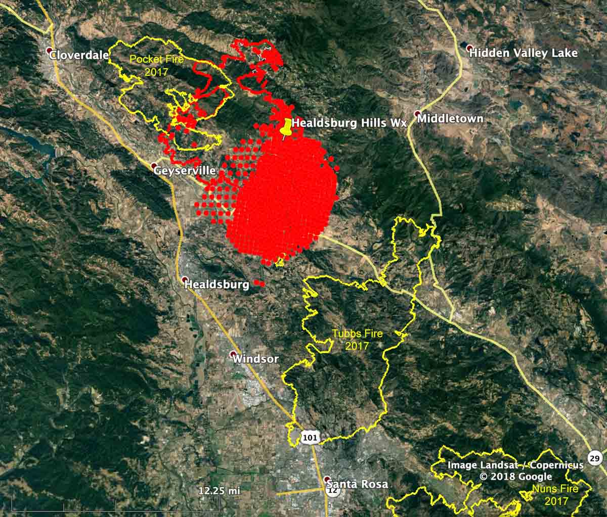
UPDATED at 9:30 a.m. October 27, 2019
Strong winds out of the northeast pushed the Kincade Fire across Highway 128 at about 3 a.m. on Sunday. A gust of 93 mph was recorded at the Healdsburg Hills North weather station at 5:50 a.m. PDT. Ten other weather stations in the area showed gusts at 50 mph or above.

Air tankers are not able to assist firefighters on the ground Sunday morning due to severe wind turbulence making it unsafe to fly and difficult for retardant to accurately hit targets.
Early Sunday morning the fire was about 10 miles north of Santa Rosa, California.
The fixed wing mapping flight at 1:36 a.m. Sunday found that the fire had burned 29,101 acres, but much additional growth has occurred since then.
The fire was moving to the southwest in the general direction of Healdsburg and Windsor. Reporters and photographers on the scene are saying structures, including the Soda Rock Winery, have burned near Highway 128.
We can confirm @SodaRockWinery is burning near Hwy 128 and East Soda Rock Ln. #KincadeFire @KPIXtv pic.twitter.com/MmWQ4KwM2g
— Katie Nielsen (@KatieKPIX) October 27, 2019
For several hours overnight Highway 101 was closed between Santa Rosa and Cloverdale but began to reopen at about 6:50 a.m. Sunday.
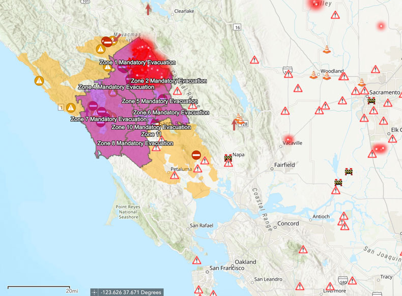
Mandatory evacuation zones stretch all the way west to the Pacific Ocean affecting 180,000 people. Sonoma County maintains current evacuation information, including a zoomable map.
Some gusts near #KincadeFire last few moments are STILL 40-80mph. This is truly a strong and sustained wind event AND we have an out of control racing into more populated areas. More to come… pic.twitter.com/XB2AYbFcRS
— Rob Carlmark (@rcarlmark) October 27, 2019
We will update this article as more information becomes available.


