


10:21 a.m. PDT August 24, 2021
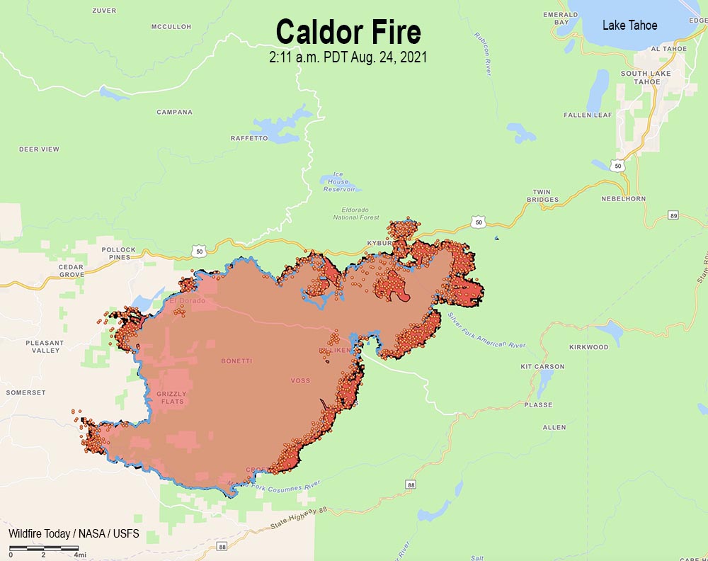
The Caldor Fire grew by about 10,000 acres Monday under the influence of a 6 mph wind gusting out of the south, southwest, and west at 8 to 15 mph while the relative humidity was in the high 20s. Most of the activity was on the southeast and northeast sides. So far crews have been able to keep it south of Highway 50 except for a spot fire near Granite Springs Road that has burned several hundred acres. During a Monday night mapping flight the fire was about two miles southwest of Sciots Camp and 14 miles southwest of Lake Tahoe.
The fire was mapped Monday night at 117,000 acres.
Monday night fire activity moderated overall, but with some small spot fires and significant terrain-driven runs on the southeast side. Humidity recovery allowed crews to engage in direct control tactics and to continue indirect line construction.
To see all articles on Wildfire Today about the Caldor Fire, including the most recent, click HERE.
The Incident Management Team (IMT) reported Monday that in three or more days the following areas have the potential to be threatened: Silver Lake, Kit Carson, Plasse, Kirkwood, Twin Bridges, Sierra-at-Tahoe, Caples Lake, and the Lake Tahoe Basin.
Monday the IMT identified a long list of “critical resource needs” requested by today, Monday, including 330 engines, 60 hand crews, 17 Division Supervisors, and 40 other overhead personnel.
The weather forecast predicts very challenging conditions for firefighters over the next two days — strong winds Tuesday afternoon, 13 mph gusting out of the south-southwest at 20 mph, with 30 percent relative humidity and 70 degrees. Overnight the wind will slow to 6 mph from the southwest, then increase again Wednesday, 14 to 17 mph gusting up to 26 mph from the southwest with the RH in the low 20s.
This weather combined with the historically low fuel moistures could result in very significant growth of the fire Tuesday and Wednesday.
Damage inspections are in progress with approximately 40 percent of the current fire perimeter having being inspected. Crews have documented the destruction of 455 residences and 11 commercial structures. On the list of structures destroyed are one school, a church, a post office, and two fire stations (Grizzly Flats Forest Service and Pioneer Fire Dept. Station 35). PG&E currently has about 3,000 customers without power.
The El Dorado County Sheriff in collaboration with CAL FIRE has released a map displaying properties that have been inspected for any damage or that have been destroyed by the Caldor Fire.


