Brian Head Fire in Utah burns 13 homes

The fire doubled in size between Wednesday night and Thursday night.

Strong winds on Thursday spread the Brian Head Fire much farther to the south and east, adding another 16,800 acres, bringing the total to 27,700. The Utah Department of Natural Resources said 13 homes and 8 outbuildings have been destroyed in the communities near Brian Head, Utah as the fire spread down Clear Creek.

Southern Utah University is opening their dorms to displaced residents of the fire ravaged town of Brian Head. The University will have room for up to 60 people. Those interested can call George Colton, Red Cross Site Director, at (435) 879-9033.
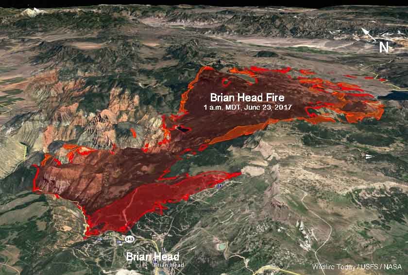
map Brian Head Fire Utah
3-D map of the Brian Head Fire as of 1 a.m. MDT June 23, 2017.

Highway 143 is closed from the cemetery in Parowan to milepost 50 outside of Panguitch.

The weather for Friday and Saturday should bring temperatures around 70, relative humidity in the low teens, and winds out of the northwest to northeast at 5 to 10 mph with gusts in the high teens. There will be virtually no humidity recovery at night; it will be no higher than the 20’s for the next two nights. For Sunday through Friday the nighttime humidity will be below 40 percent and in the teens during the day. This could allow the fire to remain active 24 hours a day. Monday through Wednesday will bring 20 mph winds, which could be problematic for firefighters.
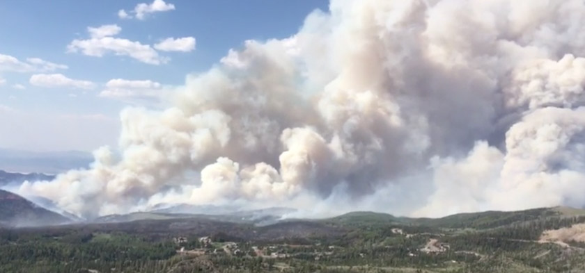
Brian Head Fire, from video uploaded to Inciweb June 21, 2017.

Wildfire forces evacuation of Brian Head, Utah

Above: The Brian Head Fire at Brian Head, Utah. Photo by Iron County Sheriff’s Office, posted June 17, 2017.

The Brian Head Fire has burned at least one home in the town by the same name, which is 12 miles east of Cedar City, Utah. As of Saturday evening the fire had burned about 957 acres on the north side of the town near the Dixie National Forest. Multiple structures are threatened.

The fire was reported at 12:20 p.m. on June 17 and caused the evacuation of all 500 residents of the town.

A Type 3 Incident Management Team was due to arrive Saturday evening, and a Type 2 Team is expected at mid-day on Sunday.

Brian Head Fire 3-d map
A 3-D map showing the approximate location of the Brian Head Fire as of 4:30 a.m. MDT June 18, 2017.
Brian Head Fire map
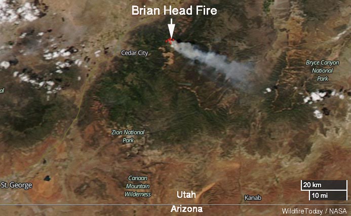
Satellite photo showing smoke from the Brian Head Fire June 17, 2017.

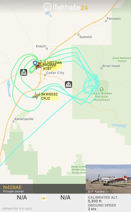
An inversion early Sunday morning trapped smoke, degrading visibility to the point where firefighting aircraft could not be used, but by noon MDT two Air Tractor 802A Single Engine Air Tankers were working the fire. They were reloading at Cedar City 12 miles away so they undoubtedly had short turnarounds in spite of the 4,000-foot climb from the air tanker base to the fire.

Brian Head Fire air tanker
Flight paths of a Single Engine Air Tanker working the Brian Head Fire at 12:50 p.m. MDT June 18, 2017.

The wind on Saturday was from the northwest, but on Sunday it shifted to come out of the north. As you can see in the image above, at about noon on Saturday the flight paths of one of the Single Engine Air Tankers were concentrated south of Brian Head, on the west side of Cedar Breaks National Monument.

The wind on Saturday is predicted to be out of the north at 8 to 10 mph with gusts to 13. The relative humidity should be in the mid-20’s and the temperature will be in the high 60’s. The coolish temperatures are due to the altitude — 8,000 to 10,000 feet above sea level in the fire area, which is about 4,000 feet higher than Cedar City.

The impressive video below posted by the Iron County Sheriff Office shows an air tanker dropping retardant apparently into heavy smoke. Perhaps there were structures or firefighters, or both, threatened in that area.