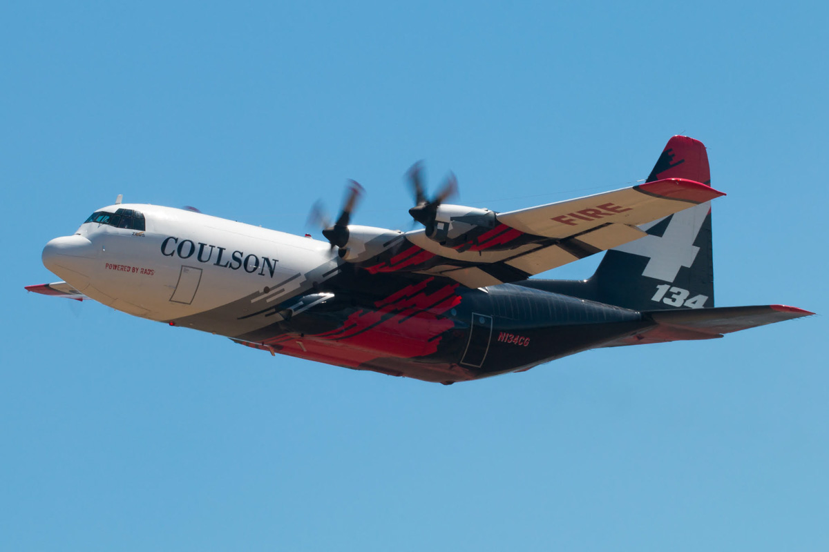
Tanker 62 at Medford, Oregon July 27, 2019. Photo by Tim Crippin.
Tim Crippin got these excellent shots of air tankers that were at Medford, Oregon July 27, 2019 supporting the Milepost 97 Fire south of Canyonville. Thanks Tim! The fire has burned 12,578 acres since it started on July 24, 2019.
Tanker 95 at Medford, Oregon July 27, 2019. Photo by Tim Crippin. Tanker 88 at Medford, Oregon July 27, 2019. Photo by Tim Crippin. Tanker 134 at Medford, Oregon July 27, 2019. Photo by Tim Crippin.
Satellite photo showing smoke from the Milepost 97 Fire in Southwest Oregon spreading across Southern Oregon and Northern California at 6:30 p.m. PDT July 27, 2019.
(Originally published at 6:08 a.m. PDT July 29, 2019)
Firefighters on the Milepost 97 Fire just south of Canyonville, Oregon were able to knock down a 20-acre spot fire Saturday and Sunday on the east side of Interstate 5 near Turkey Creek that threatened to suddenly complicate the suppression of the fire. Following that, the Incident Management Team established a Division of resources dedicated to picking up any additional spot fires across the freeway.
(To see all articles on Wildfire Today about the Milepost 97 Fire, including the most current, click here.)
Most of the active fire behavior Sunday was on the southeast side one ridge to the west of Interstate 5 about half a mile from the freeway, and two locations on the west side. Approximately 4.5 miles of the fire perimeter is adjacent to or very near the Interstate south of Canyonville. This is a step toward containment and after that area is mopped up it will reduce the chances of spotting across the highway in that location and the need to possibly close the highway to traffic in that particular area. So far the Interstate has remained open to traffic, but at times has been reduced to one lane in each direction in some areas.
A mapping flight Sunday night determined the fire has burned 11,668 acres, an increase of 659 acres in the previous 24 hours.
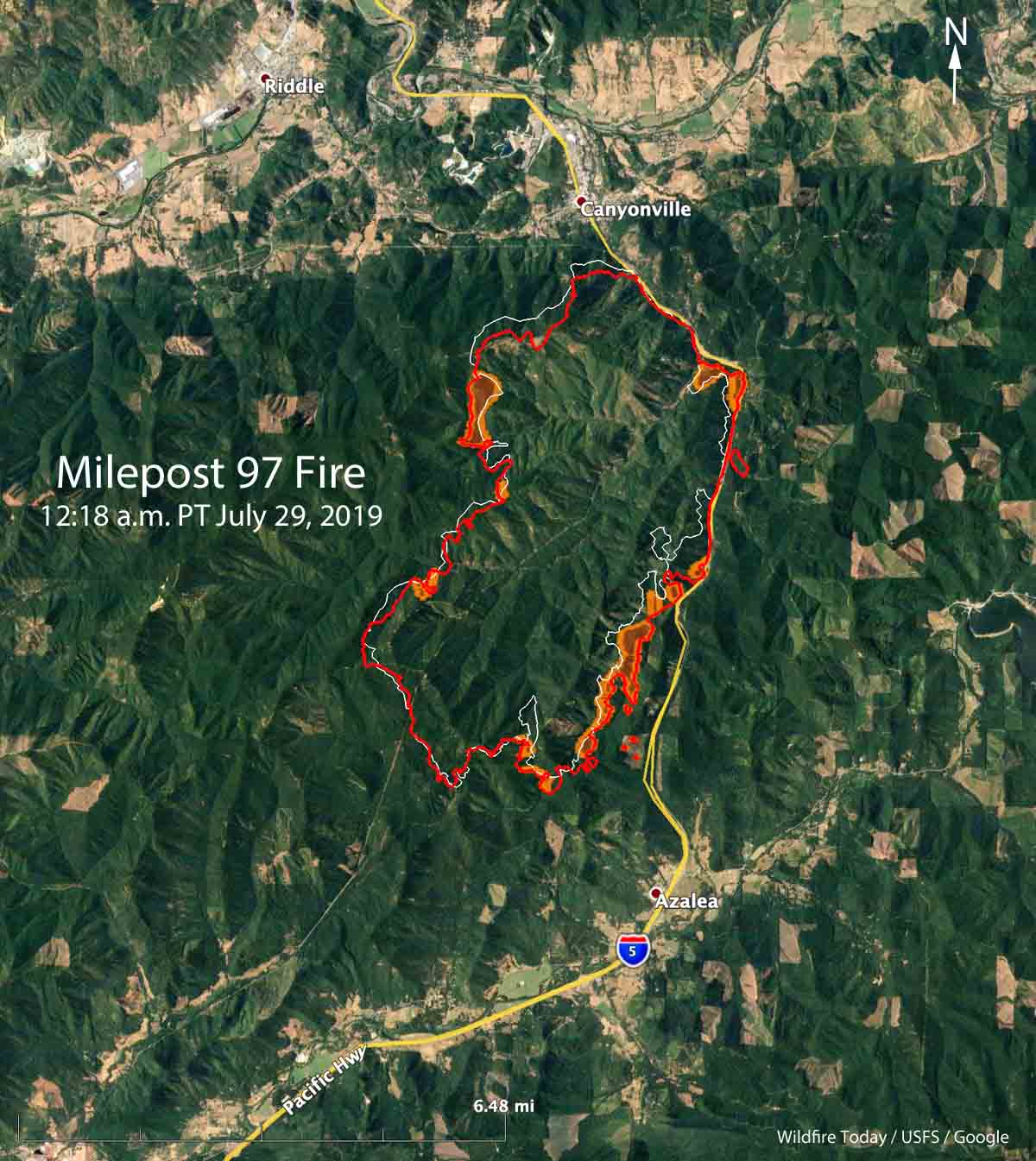
Map showing the location of the Milepost 97 Fire in southwest Oregon (the red line) at 12:18 a.m. PDT July 29, 2019. The white line was the perimeter about 27 hours before.
In the video below the Mail Tribune reports that after the fire started Wednesday, July 24 at approximately 10:00 p.m., there was only one air tanker working the fire Thursday morning beginning at 9:45 a.m. By that night the fire had grown to 1,650 acres.
On Sunday the firefighting resources assigned to the fire included 48 hand crews, 41 Engines, 45 Dozers, 14 Water Tenders, 13 helicopters, and 2 Single Engine Air Tankers for a total of 931 personnel.
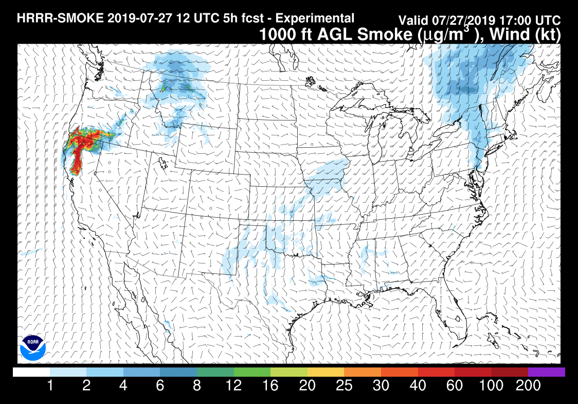
Below is an updated forecast for the distribution of smoke from the Milepost 97 Fire in Southwest Oregon. One difference from the previous version further down in this article is that not only is it proceeding further south approaching the San Francisco Bay Area, but some of the smoke will be spreading into southern Idaho. The forecast is for 6 p.m. PDT July 27, 2019.
The forecast for the distribution of wildfire smoke at 6 p.m. PDT July 27, 2019. Click to enlarge.
(Originally published at 7:15 a.m. PDT July 27, 2019)
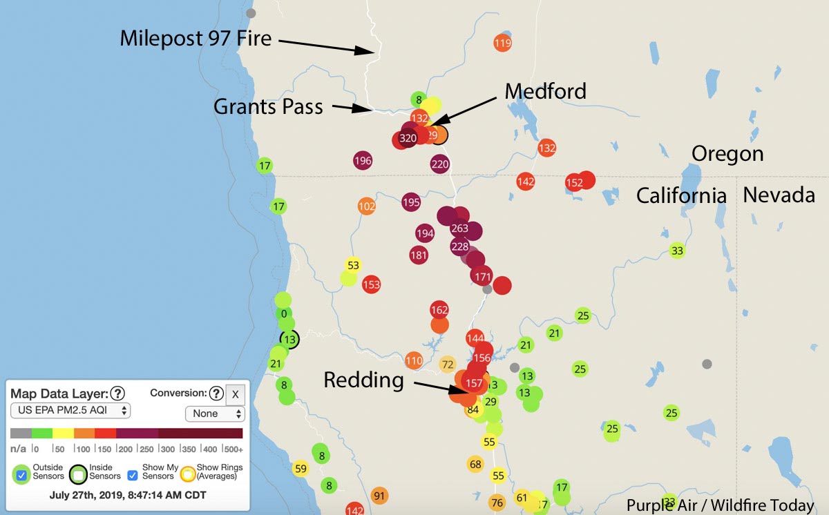
Map from Purple Air showing air quality at locations in Southern Oregon and Northern California. Cities and states identified in black by Wildfire Today.
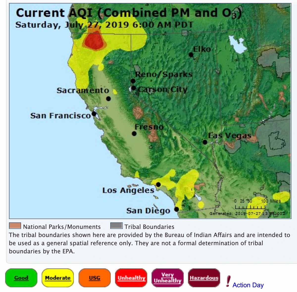
Smoke from the 8,878-acre Milepost 97 fire near Canyonville, Oregon is affecting the air quality in Southern Oregon and Northern California.
Some of the cities in Oregon affected are Grants Pass, Medford, and Ashland. And in California, Yreka, Weed, Mt. Shasta, and Redding.
California and Southern Oregon air quality at 6 a.m. PDT July 27, 2019, by AirNow. Forecast for the distribution of smoke from wildfires at 10 a.m. PDT July 27, 2019.