The National Park Service announced on its Facebook page on Friday than an unmanned aircraft system, otherwise known as a drone, took a test flight over the Paradise fire at Olympic National Park to gather infrared data.
An operational test of UAS on the Paradise fire at Olympic National Park took place recently. Learn more about the purpose of the flights and check out the footage.
Unmanned Aircraft System was a Success on the Paradise Fire
For the past week an unmanned aircraft system (UAS) was utilized on the Paradise Fire. The system was demonstrating possible applications in wildland fire management and suppression. UAS’s can supplement manned aircraft, especially at times of reduced visibility due to smoky conditions and at night when manned firefighting aircraft may be limited in flying.
The primary goal of the UAS on the Paradise Fire was to gather infrared information. This information assisted fire officials in pinpointing the fires perimeter and identifying areas of intense heat. The extremely large old growth trees in the area of the Paradise Fire create a thick canopy that makes mapping the perimeter and observing hotspots from the air very difficult without infrared capabilities.
This was an operational demonstration provided by Insitu, Inc. with no direct cost to the government. The demonstration was one of a series of ongoing missions to further UAS use on wildland fire in national parks and is part of an interagency strategy for UAS integration into wildland fire support. The Washington Department of Natural Resources (DNR) allowed the use of their land for the aircraft launch and recovery site. The purpose of the demonstration was to show the capabilities and effectiveness of unmanned aircraft technology on wildland fires. The ultimate goal for UAS use on wildland fire is to supply incident management teams (IMT) with real-time data products, and information regarding fire size and growth, fire behavior, fuels, and areas of heat concentration. Additional applications, such as search and rescue and animal surveys, may be explored.
As the fire season continues and more wildfires burn throughout the west, manned aviation resources are spread thin across the country and have become very difficult to acquire. In addition to supplementing aerial resources, UAS’s are quieter than manned aircraft, use less fuel, and present a much lower risk to employees.
This was not the first UAS to be flown in the Olympic National Park. The park partnered with the U.S. Geological Survey in 2012 to monitor sediment transport in the Elwha River as part of the Elwha restoration project using a Raven UAS.
The ScanEagle UAS that was flown on the Paradise Fire weighed approximately 50 lbs with a wingspan of 10.2 feet. The UAS was only operated within the Federal Aviation Administration (FAA) temporary flight restriction (TFR) area. The TFR has been lifted.
The Fire Effects crew from North Cascades National Park is seen in this time-lapse video filmed over a two-hour period placing fire monitoring plots just outside fire perimeter of the Paradise Fire in Olympic National Park.
The fire that started May 15 in the Olympic peninsula rain forest has burned 1,781 acres.
I wonder to what degree the intensive human activity in the plot while establishing it affects the results.
This video illustrates how the Paradise Fire is spreading through the rain forest in Olympic National Park in Washington. The fire easily climbs up the lichen and moss on a tree then drops burning embers to the ground or onto an adjacent tree branch where it can continue to spread.
The fire started May 5 and has burned 1,520 acres. It is being managed by a team from the National Incident Management Organization (NIMO).
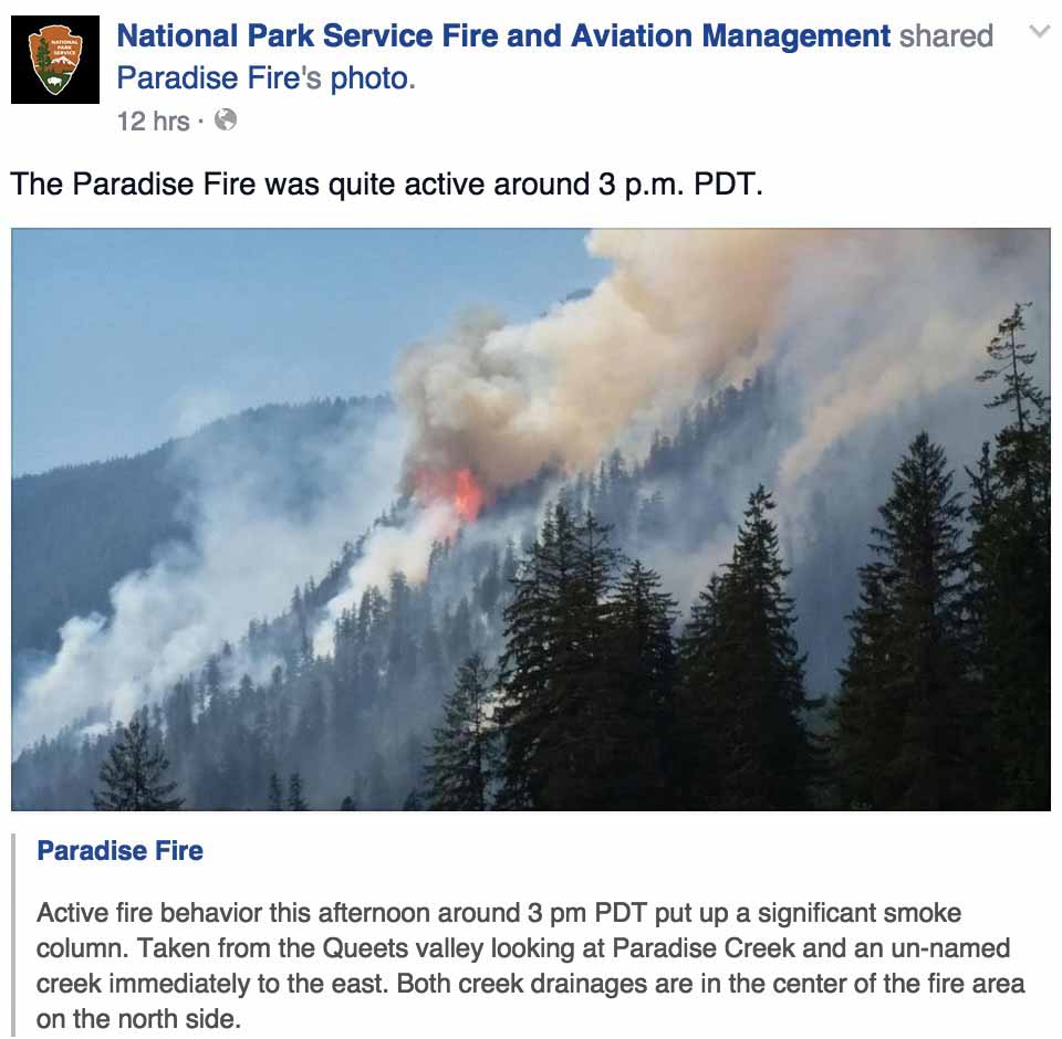
This photo and Facebook post are from July 2, 2015.
****
(UPDATED at 11:15 a.m. PT, June 29, 2015)
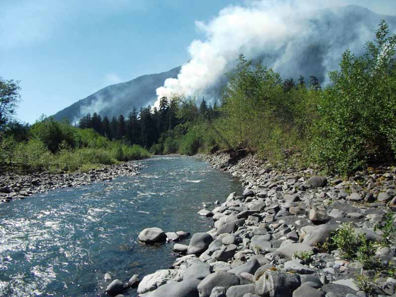
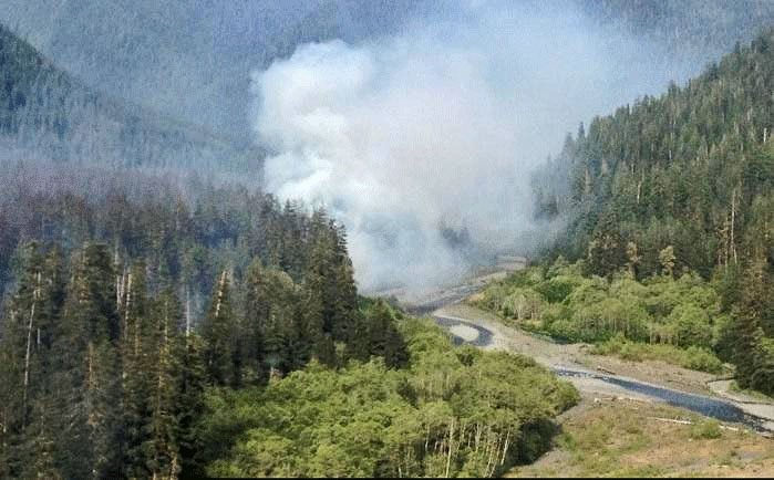
Paradise Fire. Undated NPS photo.
Below is an update on the 1,025-acre Paradise Fire in Olympic National Park, released Monday morning, June 29.
****
“Crews on the Paradise Fire reported moderating weather and limited fire growth on Sunday, a change from the previous several days of high temperatures and low relative humidity. While other parts of the Pacific Northwest experienced lightning and thunderstorms, only intermittent sprinkles fell on the fire area. A smoke inversion also contributed to a quieter day. Yesterday’s highlight for fire crews camped out in the Queets River drainage was the delivery of a satellite communications unit. This will allow the firefighters to keep in closer contact with fire management officials at the Incident Command Post in Port Angeles. The unit improves safety conditions by giving the crews access to maps and creates more secure communications links in the event of an illness, emergency, or other situation that requires increased coordination of fire management activities. It also provides a convenience of telephone and internet contact with the outside world.
Yesterday’s milder weather conditions will be repeated for the next two days as a high pressure system breaks down and is replaced by an upper level low that should last until Tuesday. However, high temperatures and increased fire potential return mid-week and are expected to remain through the upcoming 4th of July holiday weekend. Crews will continue their work to confine the fire north of the Queets River.
Olympic National Park has instituted a ban on open fires in the park’s wilderness backcountry, including all locations along the coast. Campfires are permitted only in established fire grates at established front country campgrounds. The burn restriction will remain in place until further notice. Camp stoves may still be used in the park’s wilderness backcountry, but should be operated well away from flammable vegetation and forest litter. Because of the extreme conditions on the peninsula, Olympic National Forest has also implemented fire restrictions.
The managers of the Paradise fire in Olympic National Park said today, after two recent infrared mapping flights, that the fire has been steadily moving uphill, and has now burned 949 acres.
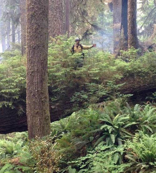
The following photo was posted on the Facebook page of the Missoula Smokejumper Visitor Center with this caption: “Good sized trees on the Paradise fire in North Cascades National Park. This fire was jumped by Redmond and NCSB jumpers. credit: @ppbutton”. They may have meant the fire was in Olympic National Park. The firefighter in the photo, possibly a jumper, appears to be traveling light.
****
(UPDATED at 3:39 p.m. PT, June 23, 2015)
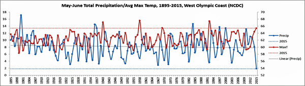
@OlympicNP Tweeted the above graphic above, saying:
A graph from the fire assessment team tells it all. May/June 2015 holds the record since 1895 for the driest on record.
You can click on the graphic to enlarge it slightly.
Here is an update posted by the Park on Tuesday:
Yesterday, clouds slowed activity on the Paradise Fire throughout the morning hours; fire activity increased when the clouds lifted in the afternoon. The fire remains north of the Queets River and the west flank is holding well. It continues to move to the east-northeast and into the high country where the terrain is exceptionally steep and inaccessible. Helicopters used bucket drops to cool the northwest corner. A reconnaissance flight in the late afternoon allowed fire managers to get a better view of the fire’s movement. An infrared flight last night revealed the fire’s exact location, which was mapped at 798 acres. A public meeting was held at the Vern Burton Community Center in Port Angeles; approximately 12 members of the public attended.
Today, crews will continue to monitor the fire activity and engage when it is safe to do so. The weather forecast calls for a chance of showers over the mountains tonight, and progressively warmer temperatures as we move closer to the weekend.Lightning is possible later in the week and this creates the potential for new ignitions.
****
(UPDATED at 8:33 p.m. PT, June 22, 2015)
A National Incident Management Organization (NIMO) team has been ordered to manage the Paradise Fire in Olympic National Park.The team consists of seven people including the Incident Commander, Fire Behavior Analyst, Public Information Officer, and specialists in Operations, Planning, and Finance.
An infrared mapping flight Monday night will give the firefighters a better idea of the size and and location of the fire.
****
(Originally published at 5:17 p.m. PT, June 21, 2015)
Paradise Fire in Olympic National Park, June 17, 2015. NPS photo.
A rare early summer wildfire in Olympic National Park’s rain forest has burned a surprising 407 acres. Fire behavior analysts have determined that this is the Olympic Peninsula’s driest year since 1951, the year of the Forks Fire.
The Paradise Fire, 13 miles northeast of Quinault, has moved into exceptionally steep terrain. Heavy mixed conifer fuels, snags, and the precipitous landscape pose a significant threat to firefighters. Rolling rocks, burning debris and falling snags are common in such areas. Smoke jumpers who had been staffing the fire were released on June 21 since after the fire spread into an area that is inaccessible. Firefighter safety remains a top priority, and crews will engage only when it is safe to do so.
“We are doing everything possible to minimize the fire’s spread, but right now we do not have many options,” said Todd Rankin, the park’s Fire Management Officer. “Traditional suppression tactics do not work in this fuel type since the fire spread is occurring in the forest canopy, not on the ground.”
Lichens, growing high in the tree tops, are catching on fire and carrying the flames from tree to tree.
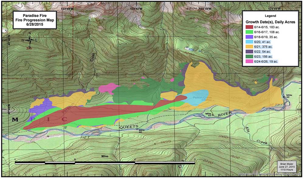
Map of Paradise Fire, June 17, 2015. Since this map was made, the fire has spread up the slope onto steeper slopes.
Large wildland fires have historically been rare in Olympic National Park’s rainforests. They generally occur in late summer, during years when it is especially hot and dry. This spring, however, the logs, dead branches, and hanging lichen in the rainforest are able burn at a time when they are usually soaked with moisture. Fire is being carried by patches of these fuels, while the understory plants and deciduous trees are still too green and moist. As a result, the burn pattern is patchy, with low and moderate severity effects.
The weather forecast calls for continued hot and dry weather, and the Paradise Fire suppression efforts will likely get more complex. A Type 2 Incident Management Team has been ordered and is expected to arrive on Wednesday. Current resources include two fire modules with 18 total firefighters, two helicopters, and numerous support personnel.