In 2014, with assistance from the New Jersey State Forestry Services, U.S. Forest Service and international researchers from the United Kingdom and Russia teamed up to collect data on a prescribed fire in the Pine Barrens of New Jersey. The fire’s embers, or commonly known as fire brands, were one important aspect of the study.
Tag: research
Wednesday morning one-liners

*The Wildland Fire Lessons Learned Center has published a report on a BIA engine that rolled over near Warm Springs, Oregon, July 18, 2014. Two people were injured, one seriously. The LLC says more than 50 fire vehicles have rolled over in the last 10 years.
*A Colorado artist has created a work consisting of rectilinear pillars suspended from the ceiling, each measuring nine feet tall, meant to convey the idea of a wildfire.
*A man spotted running from the 50-acre Foothill Fire in Ventura, California was arrested on suspicion of setting the blaze.
*Fire officials in Washington state suspect an arsonist is responsible for igniting 23 fires in less than two weeks. Most of them have been vegetation fires.
*A firefighting vehicle in Australia has been outfitted with drop-down steel wheels so that it can follow a steam-powered train, putting out wildfires started by the steam engine.
*In other news from Australia, a Senator gave a speech, titled, Thank you For Smoking, praising nicotine fiends for their $8 billion a year contribution to the economy. He said he did the math: Last year smokers cost the health care system $320 million and another $150 million in bushfire control.
*Researchers have found that “recent (2001–2010) beetle outbreak severity was unrelated to most field measures of subsequent fire severity, which was instead driven primarily by extreme burning conditions (weather) and topography.” Unfortunately, to read the article, researched and published by government employees, it will cost you $10 for two days of access. If the researchers, Brian J. Harvey, Daniel C. Donato, and Monica G. Turner, are going to hide the results of their taxpayer-funded research behind a pay wall, what’s the point in hiring researchers? Support Open Access.
*Firefighters are on alert in the Philippines for wildfires that may start from an eruption of the Mayon volcano.
*Firefighters are on lessened alert in the Black Hills after the area received two to five inches of rain over the last few days.
*California has burned through its wildfire-fighting budget — $209 million — just as it faces what is historically the worst of the fire season.
Scientists set up equipment in front of a spreading fire
(Note from Bill: A Fire Behavior Assessment Team (FBAT) has been studying the King Fire east of Placerville, California. Rae Brooks, an Information Officer at the fire, sent us this article describing what a FBAT does.)
****
These scientists set up equipment in front of a fire to collect fire behavior data
by Rae Brooks
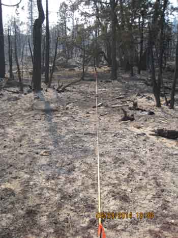
FORESTHILL, Calif. — Fire scientists call them “plots.” Dotted ahead of the leading edge of the King Fire, they were deliberately placed in the anticipated path of the flaming front. Each plot contained a video camera, wind-speed gauge and other monitoring devices.
If the flames came, a data logger buried a foot underground would collect information that would allow the scientists to better understand the science of wildfire, gauge the effectiveness of fuel treatments, and contribute to firefighter safety.
So while thousands of firefighters were building line, clearing brush from roads and bulldozing contingency lines to suppress the King Fire, the scientists patiently waited for flames to sweep over their plots, if control efforts failed.
“We want our plots to burn,” said Carol Ewell, co-lead of the FBAT, or Fire Behavior Assessment Team, at the King Fire. “Firefighters put the fire out. It’s a difficult balance.”


Mark Courson, a division-qualified firefighter and an operations section trainee, served as operations lead for the FBAT at the King Fire. His job was to keep the team safe and advise on site selection.
“Usually I’m thinking of putting the fire out,” said Courson. “Now I’m bucking the system, thinking where suppression might not hold it.”
The team, a U.S. Forest Service module, draws members from around the country to work 14-day assignments on wildfires. Since 2006, the FBAT has recorded data at 16 wildfires, including last year’s Rim Fire, the third largest in California history. Generally, emerging fires with potential for growth suit the FBAT better.
At the King Fire, just three of 10 sites selected burned over. The team averages 50 percent, but sometimes gets lucky and finds all its plots burned.
“It’s a big gamble,” said Ewell. “Our success rate is quite variable, and I’m not sure that’s a hurdle that we can fix.”
The King Fire was particularly difficult to read after it made a speedy 15-mile run northward beginning late in the afternoon of Sept. 17, Ewell said. Rain has since quelled the fire, which is now 89 percent contained.
Despite the inherent difficulties, free-burning wildfires provide conditions that cannot be replicated in laboratory, experimental or prescribed fires. For instance, no prescribed fire would ever be set during California’s current historic drought. The team has recorded active crown-fire runs, fire whirls, spot-fire ignitions, and merger of spot fires with the main flame front.
The team’s prime mission at the King Fire is to study the effectiveness of fuel treatments. Team members set up plots in treated and nearby untreated areas to provide comparisons.
Because they are working ahead of the flaming front, they follow standard firefighting safety protocols, carefully considering whether they can get safely into and out of selected sites. “Unburned fuel between you and the fire,” is one of the 18 Firefighting Watch Out Situations, and, by necessity, their equipment must be placed in unburned fuel ahead of the fire.
“There is risk involved,” said team member Matt Dickinson, an ecologist at the Delaware, Ohio, location of the Forest Services’s Northern Research Station. “One way we mitigate is to set up plots early in the day before the peak burning period. We pull out quite often when we’re not feeling comfortable.”
It takes about an hour for nine FBAT members to install their gear and inventory the vegetation at each site. If firefighters are trying to build line and the team is trying to set up a plot, the firefighters, of course, have priority, said Ewell. “In comparison, we’re just a geek squad,” she said, although most FBAT members are experienced firefighters.

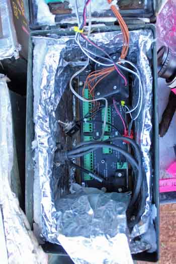
At each plot, the team sets up temperature sensors, heat flux sensors, anemometers to measure wind speed, and video cameras encased in heat-resistant steel boxes. The cameras start when trigger wires are burned over. Each camera captures about 80 minutes of footage.
The flames often melt the anemometer’s plastic cups, so wind speeds might only be collected before flames arrive. At each site, team members also bury a data logger in a military surplus ammunition box. Other members collect information about the vegetation, down to counting sticks on the ground.
At the King Fire, the team also recorded fuel moisture data to help fire behavior analysts working on the fire.
In the future, Ewell would like to equip the team with more heat-flux sensors, Go-Pro video cameras with new triggers, and anemometers that can better withstand heat. The team relies on grant money and project funding from the Forest Service to continue its work.
When sites burn over, team members return, when it is safe, to collect their equipment and the data. They also record how the vegetation has fared. Plots that don’t burn are permanently marked with rebar, so they can provide fuels information for other uses.
The team spends evenings entering data and crunching numbers, and tries to complete a summary report before demobilizing from a fire.
Seeing a wildfire burn during severe drought has been an eye-opener, said Dickinson. Most of his experience has been with prescribed fires. He found the tremendous consumption of fuels and the severe damage to trees hard to witness.
William Borovicka, who normally works at the Vinton Furnace State Experimental Forest in McArthur, Ohio, was a first-time FBAT member at the King Fire. Back home, he studies how oak and hickory forests, if left undisturbed, convert to beech and maple woods. His work in Ohio, he feels, plays into management techniques to stabilize the oaks and hickories.
Using FBAT findings to gain a deeper understanding of fire behavior might similarly help forest managers someday with decision-making, Borovicka said.
“Maybe more prescribed fires, or different harvesting techniques,” he said. “Whatever it takes to prevent this kind of blow-up.”
Revised guidance for safety zones is released

In his continuing efforts to improve the recommended standards for wildland firefighters’ safety zones, researcher Bret Butler has released a revised version based on additional research. Dr. Butler developed the guidelines that had been used for years which were based on the height of the flames, but in May, 2014 released a new recommendation that was based on height of the vegetation, wind speed, slope, fire intensity, and a constant number. This new July, 2014 version replaces the one that was released in May.
A safety zone is an area where wildland firefighters may be forced to take refuge from an approaching wildfire. There, a firefighter should be able to survive without being injured from exposure to the radiant and convective heat from the fire, and would not have to deploy and enter a fire shelter.
The latest version of the guidelines released a few days ago is based on height of the vegetation, wind speed, slope, and the same constant number (8). It removes a factor that could be a little subjective or difficult to quantify accurately in the field, fire intensity.
The new system, like the one unveiled in May, calculates the Safe Separation Distance (SSD) between the fire and the firefighters. To determine the SSD, using the table above multiply the constant number (8) times the number from the table (Slope-Wind Factor) times the height of the vegetation.
Example for 15 mph wind, 24% slope, 6-foot vegetation:
The Safe Separation Distance is 8 x 3 x 6 = 144 feet
Dr. Butlers’ Additional Considerations:
- For a 20-person crew, add 10 feet of radius and for a vehicle add another 5 feet of radius.
- The area in red requires large natural openings or construction by mechanized equipment.
- The proposed rule is to be used for flat ground rather than the existing flame height rule.
- Also consider additional lookouts on the ground and in the air to monitor fire activity with early egress to escape routes and safety zones.
- At 30% or greater slopes, hot gases tend to stay close to the ground.
Dr. Butler’s disclaimer: This proposed safety zone rule should be considered preliminary because it is based on limited data and analysis and subject to increase or decrease based on additional data. It is presented for release this fire season with the intent of increasing firefighter safety and reducing risk of injury. It is likely that an updated rule will be released in the next year.
For more information see the article in the International Journal of Wildland Fire titled: Wildland Firefighter Safety Zones: A Review of Past Science and Summary of Future Needs
We will let you know if another revised version of the guidelines is released in two months.
(NOTE: if you want a copy of the table above, click on it to open it in a window of its own, then click on Print in your internet browser.
Thanks and a hat tip go out to Ryan.
Unique display of results from fire effects study

The Alaska National Park Service Fire Ecology crew returned to the site of the Currant Creek Fire in Lake Clark National Park and Preserve in Alaska one year after it burned in order to collect data about the effects of the fire. They created an interactive map tour of their findings, which turned out to be a pretty interesting educational tool.
Thanks and a hat tip go out to Traci.
Wildfire briefing, June 4, 2014
Up to 20 large air tankers this year
There could be as many as 20 large air tankers on exclusive use contracts this year, the largest number since 2009. This increase follows the downward spiral in the number since there were 44 in 2002. Fire Aviation has the details, but below is a list.
Galahad fire on the north rim grows to 2,702 acres
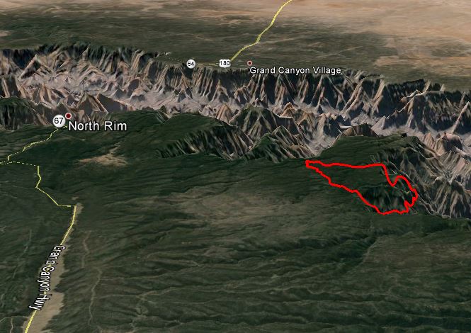
The National Park Service is managing, rather than completely suppressing, the Galahad Fire in Grand Canyon National Park. But one thing in their favor is a mile deep gorge, the Canyon itself, that provides a pretty good barrier on the south side. Below is the most current 3-D map — more details are in our main article about the fire.

Richard Rothermel receives award

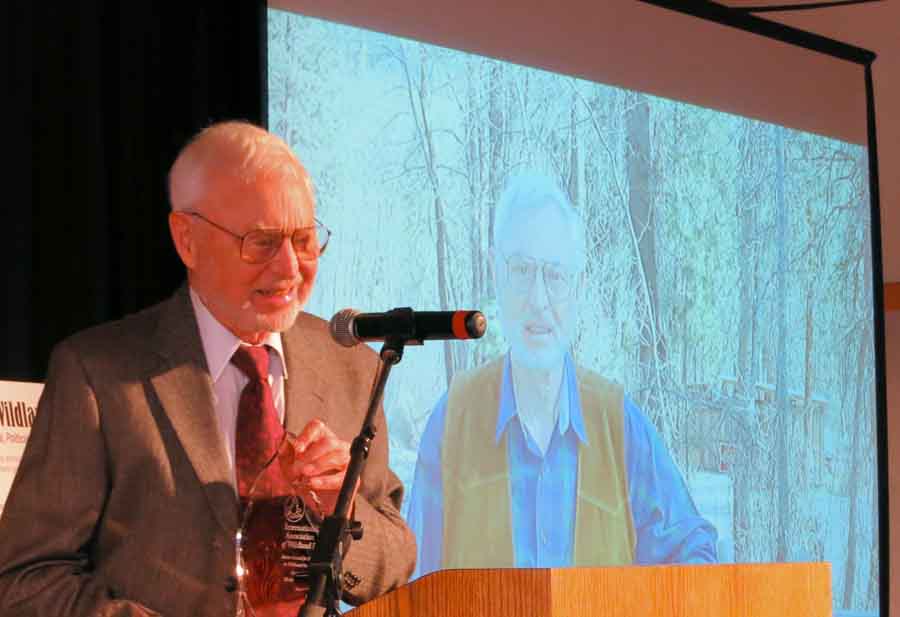
At the Large Fire Conference in Missoula Dick Rothermel received the International Association of Wildland Fire’s Ember Award for Excellence in Wildland Fire Science. It was presented by Dr. Domingos Viegas, who said in part:
…Dick Rothermel started his activity in the field of forest fires in the sixties and was a leading member of a research team working on fire retardants and fire behavior research at the World famous Missoula Fire Research Laboratory for almost thirty years. Dick brought his engineering approach to develop a very innovative and comprehensive research program on fire spread. Based on the past work from his team and from others that preceded him, Dick used his skills and intuition to identify the most relevant factors of fire spread, to formulate quantitative relationships among them in a quite general form and develop the Mathematical Model on Fire Behavior Prediction. The famous report presenting the Rothermel’s Model as it is universally known was published in 1972 as we all know, is possibly one of the most cited documents in forest fire literature. The Rothermel model was incorporated in a consistent system designated Behave that was released in another historical report in 1983.
IAWF scholarships
The International Association of Wildland fire recently announced the award of two scholarships to students studying wildland fire. The recipients were Miltiadis Athanasiou, a PhD student at the National and Kapodistrian University of Athens, Greece, and Trisha Gabbert, a MSc student at the South Dakota School of Mines and Technology, USA. (As far as I know, the author of this artcle is not a relative of Ms. Gabbert.) More information.

