

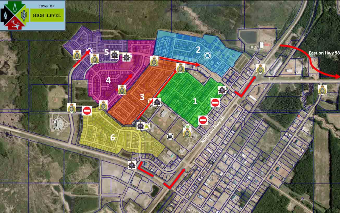
The town is in the northern portion of Alberta and had a population of 3,159 in 2016.
(To see all of the articles on Wildfire Today about the Chuckegg Fire, including the most recent, click here.)
An area north of the town of High Level is under a voluntary evacuation notice.

Some of the homes in High Level are very close together which will make it difficult for firefighters to defend the structures if the fire enters the community pushed by a strong wind.


