


(UPDATED at 8:24 p.m. PST December 7, 2017)
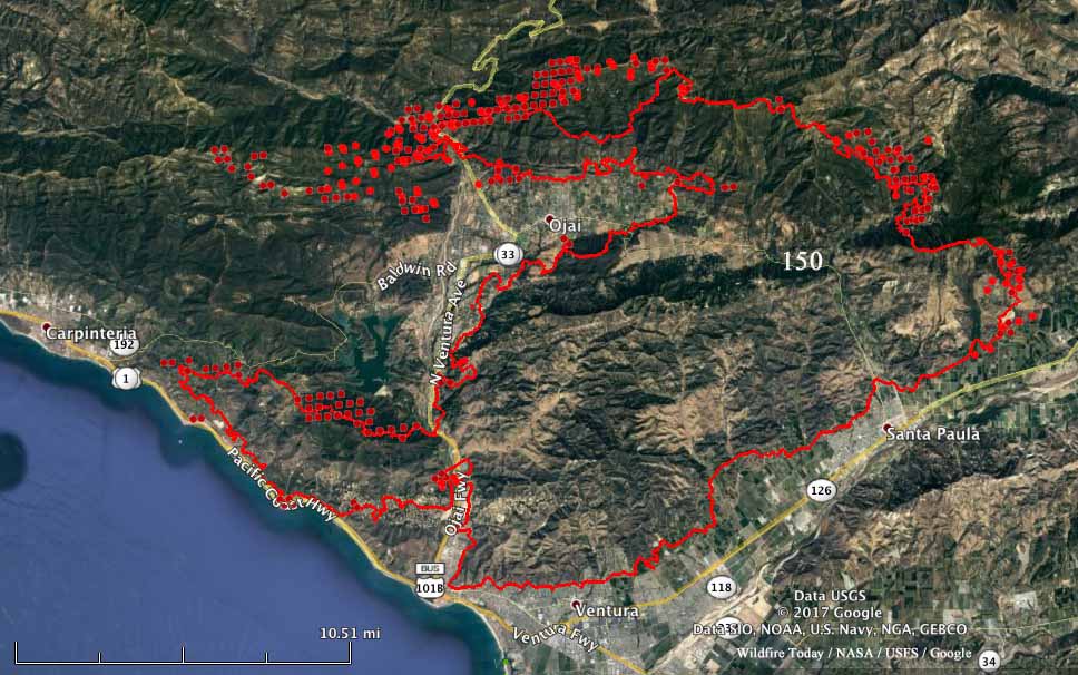
The northeast and northwest sides of the Thomas Fire continued to be very active again on Thursday. Fire authorities said 427 structures in Ventura have been destroyed and at least 85 more were damaged. Approximately 12 were destroyed in unincorporated areas of Ventura County. Ojai is becoming even more boxed in by the fire, but so far that community and Carpinteria, where the blaze is knocking on the southern boundary of the city, have avoided any large losses in the fire.
(All articles about the Thomas Fire on Wildfire Today are tagged “Thomas Fire”.)
The additional area burned Thursday brings the total number of acres up to approximately 129,000 according to our estimates. At 6:30 p.m. CAL FIRE was calling it 115,000 acres.
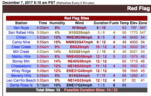
Until the strong Santa Ana winds subside, there is not a lot that firefighters can do to stop major spread of the fire.
****
(UPDATED at 1:15 p.m. PST December 7, 2017 to include a better map below)
Strong winds Wednesday night from the east and northeast continued to push the Thomas Fire further to the west and north. It spread along the coast toward Carpinteria and as of 2 a.m. Thursday was about a mile south of Highway 150 where the road enters the city.
The fire also moved around Ojai on the north side, blazing a new path to the west two miles wide by eight miles long and crossing, again, Highway 33 northwest of the city. Ojai is now surrounded on three sides by the Thomas Fire.
Click on the map below to see a larger version.
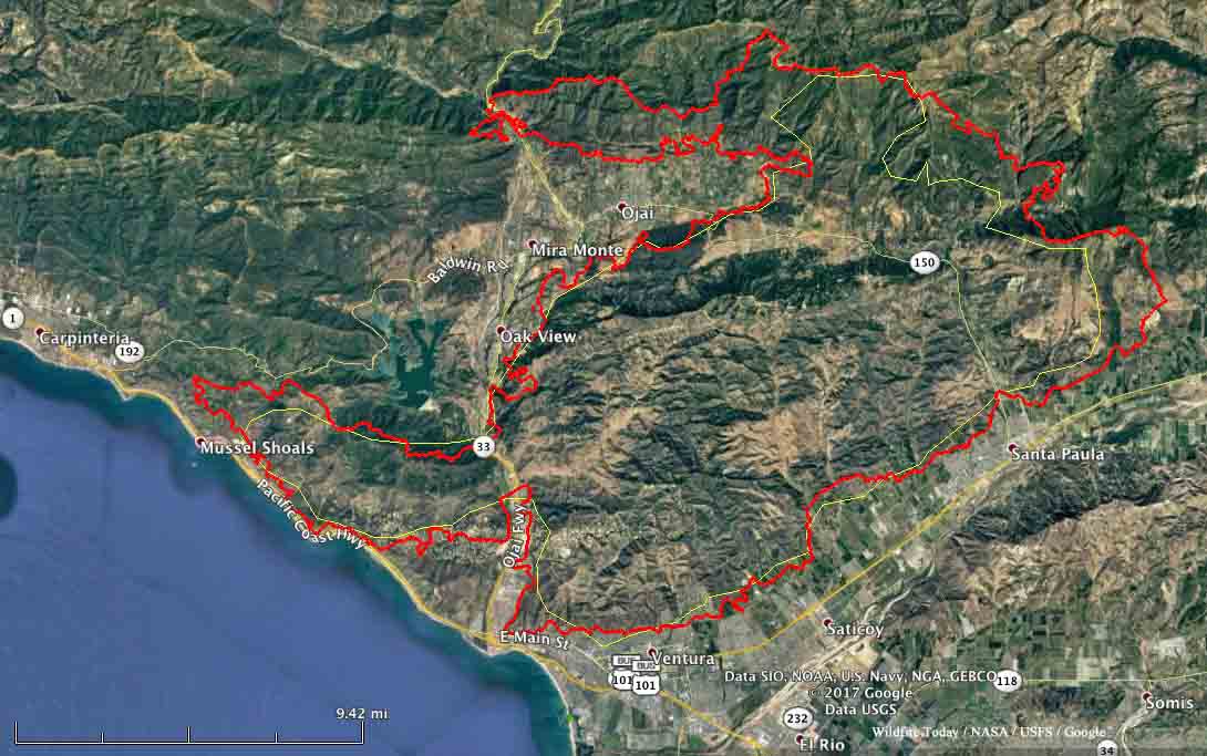
The Ventura County Fire Department is calling it 96,000 acres, but we think it was least 112,000 acres when the data for the map above was collected at 10 p.m. December 6. The unofficial threshold for a fire to obtain “megafire” status is 100,000 acres… so, it qualifies.
Wednesday night a weather station at Oxnard recorded east and northeast winds of 12 to 27 mph gusting up to 32 mph.
Evacuations have been ordered for areas near Carpinteria and Ojai.
#BREAKING Evacuation orders issued for coastal Carpinteria in Santa Barbara County as #ThomasFire rageshttps://t.co/ZKIIPRDtVI
— ABC7 Eyewitness News (@ABC7) December 7, 2017
New mandatory evac in Ojai: All areas within the City of Ojai east of Hwy 33 and north of Hwy 150 w/ the exception of Ojai Valley Community Hospital and the evac center at Nordhoff High School.
o Ojai Valley Community Hospital – Shelter in Place
o Nordhoff HS – Shelter in Place— Matt Hamilton (@MattHjourno) December 7, 2017
#ThomasFire Highway 101 closed in both directions north of Ventura SR 126 to Highway 150
— VCFD PIO (@VCFD_PIO) December 7, 2017
#thomasfire #ojaifire pic.twitter.com/IcQI2borE0
— OnScene.TV 306 (@EPN106) December 7, 2017
Articles on Wildfire Today about this fire are tagged Thomas Fire.


