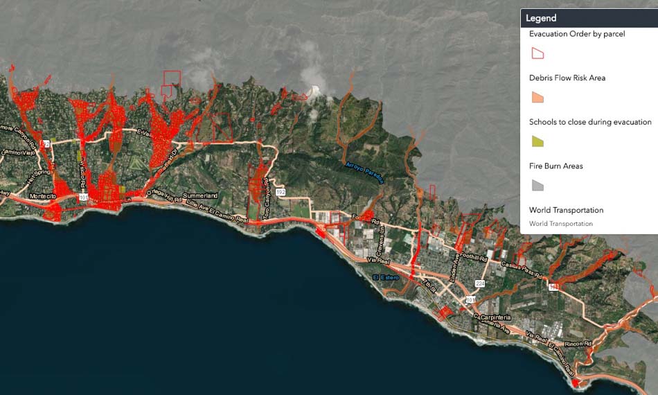
Three to four thousand residents in areas below the footprints of three recent fires in Southern California’s Santa Barbara County have been ordered to evacuate as a winter storm approaches which could lead to debris flows below the Sherpa, Whittier, and Thomas fires burn areas. The evacuation order is in effect beginning at 10 a.m. Tuesday January 15.
Santa Barbara County has more information about the evacuation, including a map. A Red Cross shelter will be open at 10 a.m. at Goleta Valley Community Center, 5679 Hollister Ave., Goleta. Two schools are closed and three are holding classes at alternative sites.
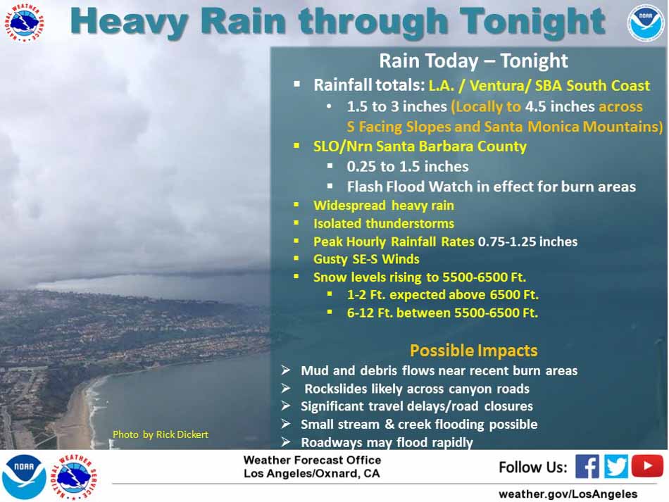
The National Weather Service is predicting 1.5 to 3 inches of rain in the Santa Barbara area with up to 4.5 inches locally on south-facing slopes. Peak hourly rainfall rates could reach 0.75 to 1.25 inches. The heavy rain should taper off Tuesday night, followed by showers on Wednesday which will increase to heavy rain again Wednesday night.