


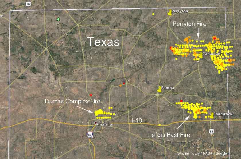
Above: A map of the northern part of the Texas panhandle shows the three large fires in the area. The dots represent heat detected by satellites, with the red ones being the most recent.
In addition to the wildfires that have burned hundreds of thousands of acres in Kansas and northwestern Oklahoma, firefighters in the northern part of the Texas panhandle have been very busy in the last two days. According to the Texas Forest Service on Tuesday, at least 436,000 acres have burned in three large fires.

Two homes were destroyed in the 315,135-acre Perryton Fire in Ochiltree, Lipscomb and Hemphill counties. The fast-moving wind-driven fire threatened the towns of Higgins and Glazier.
The Lefors East Fire southeast of Pampa in Gray county burned 92,571 acres.
Just north of Amarillo the Dumas Complex of fires in Potter County was spread by winds gusting over 50 mph to blacken 29,197 acres.
The videos below shows the conditions the firefighters have to occasionally work in.


