


Firefighters have made progress on the 77,102-acre Rafael Fire in Arizona. In a video briefing Monday morning Operations Section Chief Rocky Gilbert said due to the firing operations completed on the northeast side there is no longer a threat to the city of Flagstaff.
Their map shows that at least half of the perimeter is held fire line (the black line), and officially the Incident Management Team reports that the fire is 48 percent contained. There is still much work to be done on the northwest and south sides. The map below of heat detected by a satellite Sunday night shows quite a bit on the northwest side, but almost none on the southern perimeter.
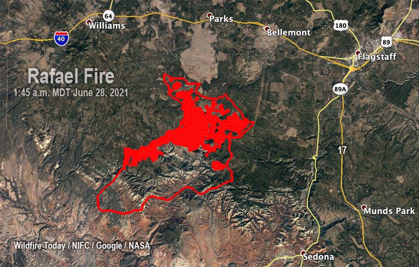
The Rafael Fire is:
-
-
- 6 miles south of Interstate 40
- 13 miles southwest of Flagstaff
- 7 miles west of Highway 89A, and
- 10 miles northwest of Sedona
-


