


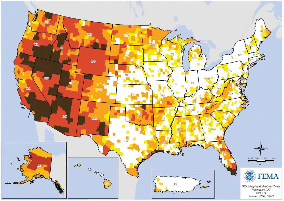
 FEMA produced this interesting map that plots the number of wildfires, by county, that were 300 acres or larger between 1994 and 2013.
What do you think? Any surprises?
(UPDATE, May 3, 2017: We have a different map of fire activity derived from satellite data, not reports submitted by fire departments.)


