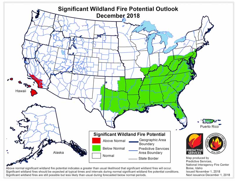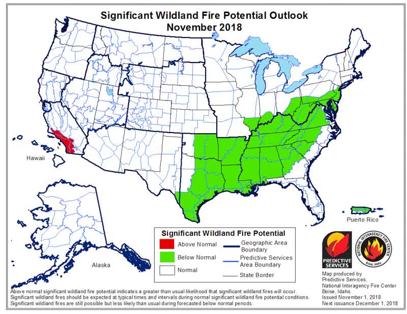
On November 1 the Predictive Services section at the National Interagency Fire Center issued their Wildland Fire Potential Outlook for November through February. The data represents the cumulative forecasts of the ten Geographic Area Predictive Services Units and the National Predictive Services Unit.
If their analysis is correct, the only areas with above normal wildfire activity during the period will be Southern California in November and December, and Hawaii December through February.
Below:
- An excerpt from the NIFC narrative report for the next several months;
- More of NIFC’s monthly graphical outlooks;
- NOAA’s three-month temperature and precipitation forecasts; and,
- Drought Monitor.
“Much of the West exited fire season by early October as the frequency of wet systems moving across the country increased. Cooler temperatures brought higher humidity levels and good overnight recoveries which also reduced large fire potential. As anticipated, the frequency of Santa Ana and North Wind events across California was lower than average, so critical fire weather periods were infrequent and of short duration. Nevertheless, fire activity was observed in isolated locations across the region in the remaining pockets where fuels remained critically dry. The Klondike fire made large runs mid-month. In the East, fire activity was also less active than average. This was due to the onset of a weak El Niño which promoted wetter than average conditions. The primary draw on resources was in response to Hurricane Michael which made landfall at Mexico Beach, Florida, with 155 mph winds.
“While most regions of the country are out of fire season during November, varying levels of activity are observed across California and the Southeast. The onset of El Niño should allow for a continuance of wetter than average conditions across the Southeast which should limit fire activity. However, pockets of critically dry fuels will persist across California, especially along coastal areas and along the front of the Southern Sierra. These areas will remain susceptible during wind events.
“Climatologically speaking, fire activity during the winter months, December through February, is at a minimum. Areas most susceptible to activity are generally restricted to the southeastern states where periodic increases in fire activity are possible during dry periods until spring greenup begins. However, current data and expected trends in precipitation suggest that large fire potential will be Below Normal in this region. The abundance of moisture should keep fuels in most areas from becoming critically dry. Drought forecasts project that the region should remain mostly free of drought.
“Across the West, overall warmer and drier than average conditions are expected. This should lead to below average snowpack in most mountain locations across the northern tier of the country. Snowpack should trend toward average levels moving south along the Continental Divide as the impacts of the El Niño begin to produce a positive effect on precipitation amounts received.”