


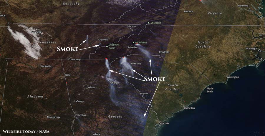
Above: Satellite photo from Sunday afternoon, November 20, showing plumes of smoke.
The amount of smoke created by wildfires in the southeastern United States decreased on Sunday. In satellite photos from last week smoke could be seen that covered large portions of South Carolina, Georgia, and North Carolina. However as you can see in the photo below, the smoke increased on Monday.
The amount and location of the smoke varies depending on the wind direction and the fire activity. It is difficult to predict more than a day in advance the quantity and location of smoke.
Below are maps predicting air quality information and the location of smoke for today, November 21.


For the latest articles at Wildfire Today about how smoke from the wildfires is affecting various locations in the South, check out the articles tagged “smoke”.


