


(UPDATED at 4:30 p.m. MDT, May 8, 2016)
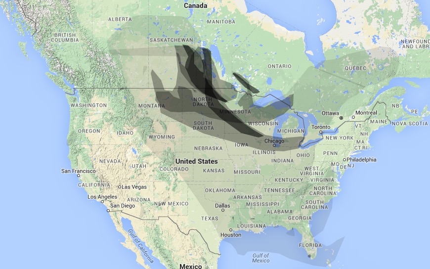
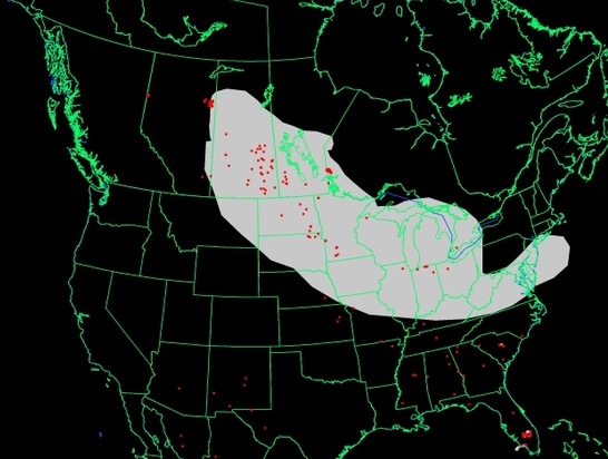
These first two maps are updated versions of the wildfire smoke maps down below. The smoke has gotten a little closer to the northeast United States.
****
(Originally published at 12:31 a.m. MDT, May 8, 2016)

The fires in Alberta, Canada continue to create smoke that drifts into into Saskatchewan, Manitoba, the central United States, and many areas in the eastern U.S.
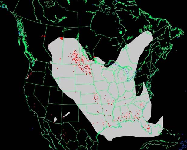
To see the most current smoke reports on Wildfire Today, visit the articles tagged “smoke” at https://wildfiretoday.com/tag/smoke/
The massive wildfire in Alberta, Canada continues to grow. Smoke from the fire even reached Florida this afternoon. pic.twitter.com/vXnFxSozya
— Bryan Bennett (@WFLABryan) May 8, 2016
Sunset this evening by our office. Brilliant orange from the wildfire smoke in the air. #laxwi #wiwx pic.twitter.com/QdfBTvO0Fb
— NWS La Crosse (@NWSLaCrosse) May 8, 2016
YIKES! Smoke seen this morning in #Minneapolis, Minnesota from wildfires near Bemidji & Alberta. #YMMfire #MNwx pic.twitter.com/CiO5b03ckZ
— Mark Tarello (@mark_tarello) May 7, 2016







