


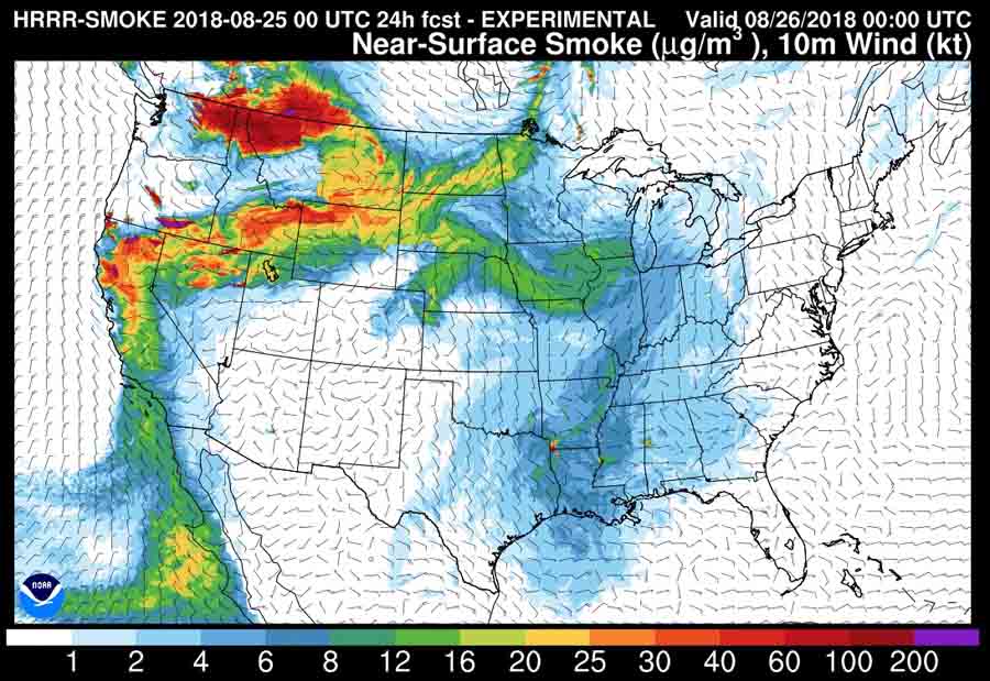
The map above is the forecast for the distribution of wildfire smoke at 6 p.m. MDT August 25, 2018. The states being the hardest hit today include California, Nevada, Oregon, Washington, Idaho, Montana, and Wyoming.
Below are the areas under Red Flag Warnings (red) on August 25 and Fire Weather Watches (yellow).
 Areas under Red Flag Warnings (red) on August 25 and Fire Weather Watches (yellow).


