


These maps depict the prediction for wildfire smoke at 4 p.m. MDT August 7, 2019. As you can see, they are different. The first one is for near surface smoke — that is, smoke that is within 26 feet of the ground. The second one shows vertically integrated smoke, more than 26 feet above the ground ranging up to high in the atmosphere.
Below the maps are more details about the two different heights of smoke. Which map would you prefer to see on Wildfire Today?
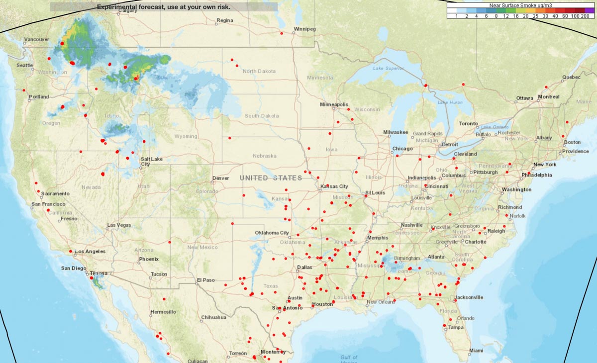

“Near-surface smoke” refers to the smoke that will hover within 8 meters (26 feet) of the ground—the kind responsible for burning eyes and aggravated asthma. “Vertically integrated smoke” depicts all of the smoke in a vertical column, including smoke high in Earth’s atmosphere. That is the smoke you see at sunrise and sunset. The animation below shows a 36-hour forecast of vertically integrated smoke on August 6, 2018.
“Near-surface smoke is one indicator of air pollution, but the smoke could also be at much higher altitudes,” said Ravan Ahmadov, the main developer of the HRRR-smoke model, and a research scientist at NOAA’s Earth Systems Research Laboratory and the Cooperative Institute for Research in Environmental Sciences. “That’s important to know, because the smoke could affect visibility for aviation.” High-altitude smoke can also block incoming sunlight, which can cool air temperatures and interfere with solar energy production.”


