


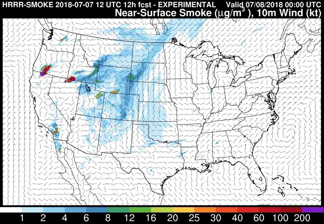
The map shows the prediction for the distribution of near-surface wildfire smoke at 6 p.m. MDT July 7, 2018. The states that are the most affected include portions of California, Oregon, Nevada, Idaho, Montana, Wyoming, Utah, Colorado, Nebraska, South Dakota, and North Dakota.


