Skip to content
About Us
Contact Us
Advertise
Subscribe
About Us
Contact Us
Advertise
Subscribe
×
Search
News
Fire Aviation
Safety
Innovation
Research
New Online
IAWF News
Reports
Events
News
Fire Aviation
Safety
Innovation
Research
New Online
IAWF News
Reports
Events
Search
Fire Aviation
IAWF News
New Online
News
Innovation
Reports
Research
Events
Safety
About Us
Advertise
Contact Us
Fire Aviation
IAWF News
New Online
News
Innovation
Reports
Research
Events
Safety
About Us
Advertise
Contact Us
News
Fire Aviation
Safety
Innovation
Research
New Online
IAWF News
Reports
Events
News
Fire Aviation
Safety
Innovation
Research
New Online
IAWF News
Reports
Events
Fire Aviation
IAWF News
New Online
News
Innovation
Reports
Research
Events
Safety
About Us
Advertise
Contact Us
Wildfire smoke map, July 8, 2017
Bill Gabbert
July 8, 2017
Map showing the distribution of smoke from wildfires, 3:47 p.m. MDT July 8, 2017.
Above: Map showing the distribution of smoke from wildfires, 3:47 p.m. MDT July 8, 2017.
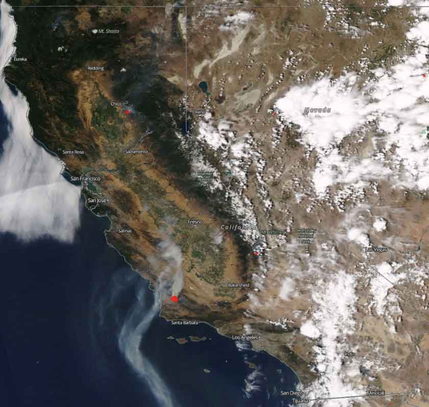
Satellite photo showing smoke from the Alamo Fire near Santa Maria, California, July 8, 2017. NASA. Click to enlarge.
Comments
More in Reports
October 12, 2026
/
2 minutes
Tales from a muddy lake – how the fire story in Australia changed when colonisation began
October 11, 2026
/
2 minutes
‘Pyroterrorists’ may increasingly use wildfire as a weapon, expert warns
October 7, 2026
/
2 minutes
Fewer destructive fires in Kimberley landscape due to Indigenous-led burning: study