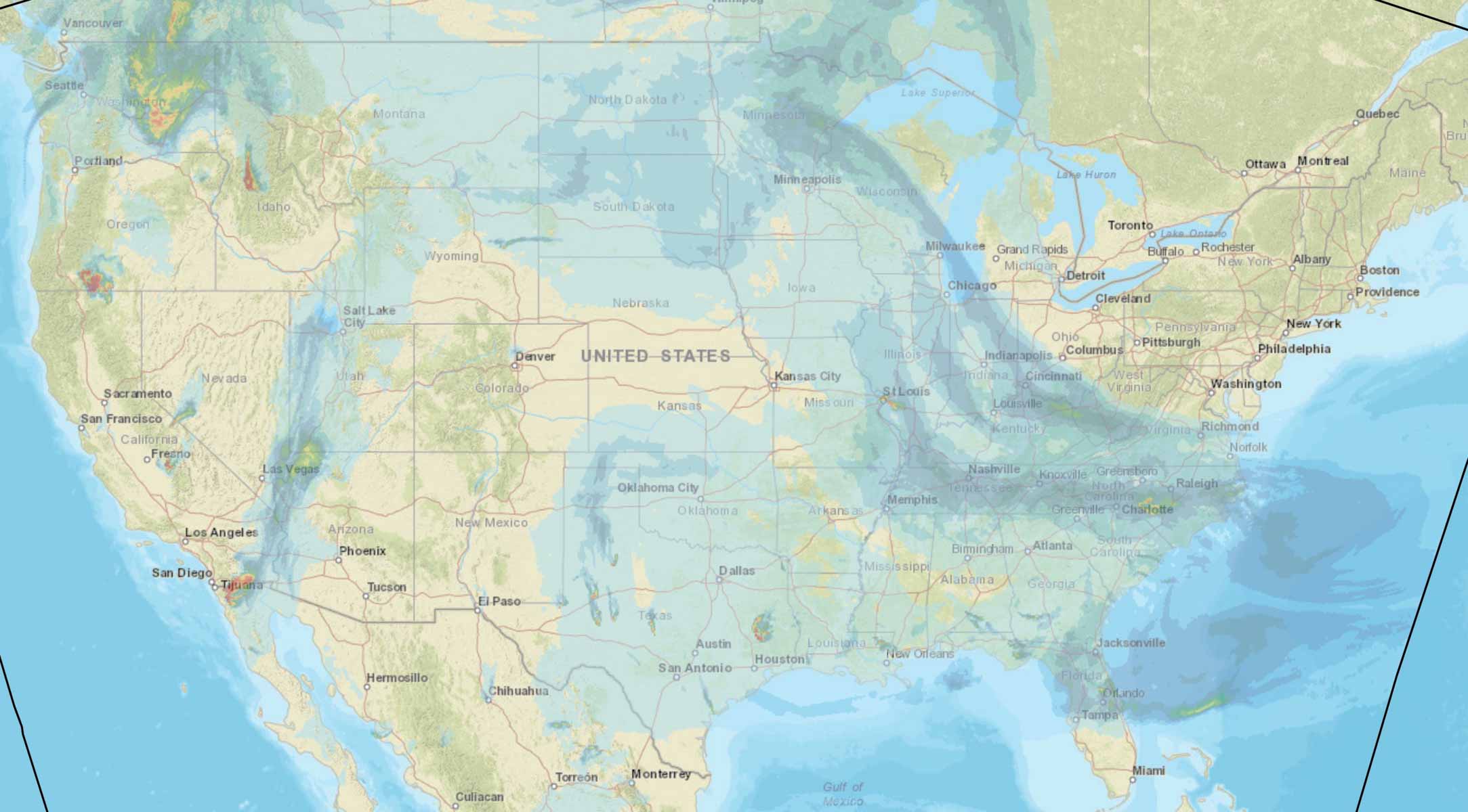
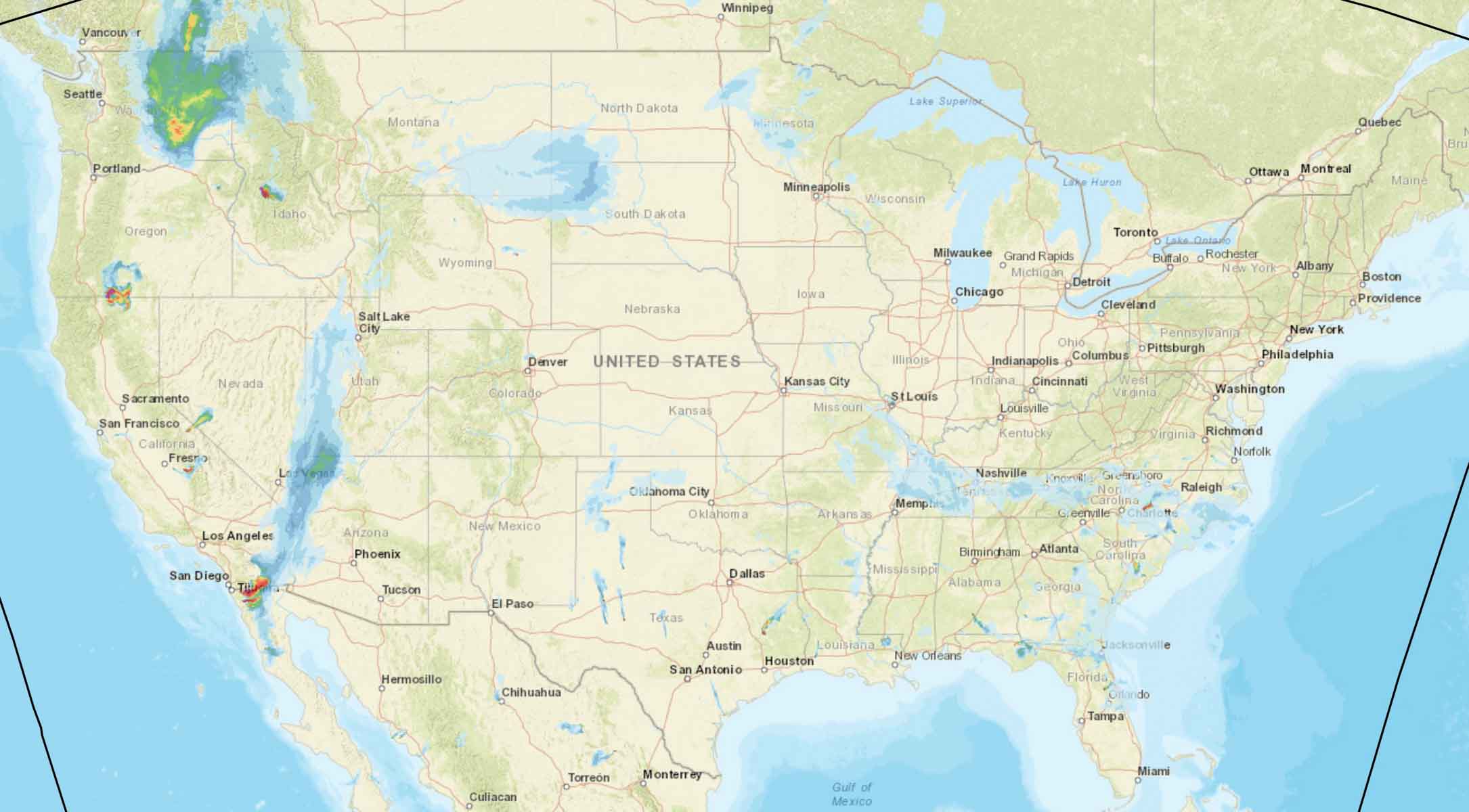
These maps predict the distribution of smoke from wildfires at 5 p.m. PDT August 10, 2019.
The first map is for vertically integrated smoke, depicting all of the smoke in a vertical column, including smoke high in Earth’s atmosphere. That is the smoke you see at sunrise and sunset.
The second map shows near surface smoke that will hover within 8 meters (26 feet) of the ground—the kind responsible for burning eyes and aggravating asthma.