Skip to content

Wildfires continue to spread in Kansas, Oklahoma, and Texas

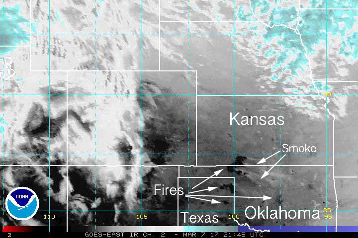
map wildfires kansas oklahoma
Burned areas and wildfire smoke can be seen in this 3:45 p.m. infrared satellite image from Tuesday. Click to enlarge.

The wildfires that grew to blacken hundreds of thousands of acres continue to grow larger in Kansas, Texas, and Oklahoma on Tuesday.

In the map below the red dots represent wildfire heat detected by a satellite at 12:57 p.m. CST March 7, 2017. The white line was the very rough, approximate perimeter we developed from heat detected by satellites on Monday. The fires are still growing on Tuesday, spreading toward the southeast, pushed by strong west and northwest winds gusting at 20 to 40 mph. The relative humidity in the western two-thirds of Kansas has fallen Wednesday to the single digits.

The towns of Protection and Coldwater in Kansas are threatened.

The red dots represent wildfire heat detected by a satellite at 12:57 p.m. CST March 7, 2017. Click to enlarge.
weather kansas wildfires
Kansas weather data at 2:41 p.m. CST March 7, 2017. The red numbers are the relative humidity while the wind barbs indicate the wind speed and direction. Click to enlarge.
radar wildfire smoke
At 4:45 p.m. CST on March 7 radar was picking up smoke from the fires southeast of Dodge City, Kansas. Click to enlarge.

Comments

More in Reports