


(Originally posted at 5:18 p.m. MT, June 11, 2013; revised at 8:20 a.m. MT, June 12, 2013)
There are at least three major fires burning in Colorado.
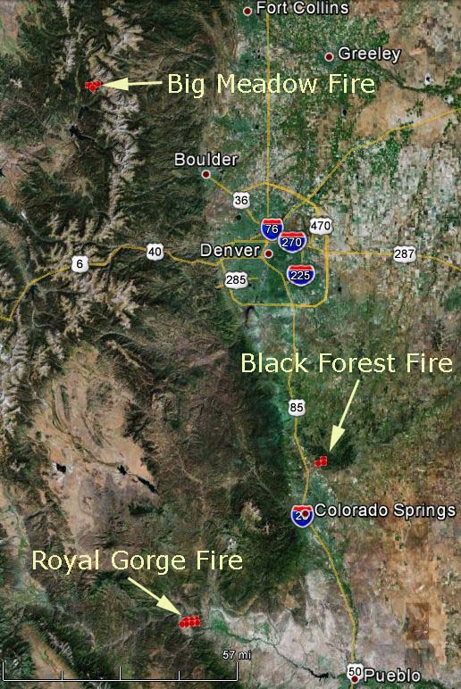
This first map shows the general locations of three fires: Big Meadow in Rocky Mountain National Park, Black Forest near Colorado Springs, and Royal Gorge at Canon City southwest of Colorado Springs. The red squares represent the approximate location of heat detected by a satellite at 2:40 p.m. June 11, 2013.
Map of all three fires:
Big Meadow Fire
The most current maps and information about the Big Meadow fire are now being posted in an updated location.

Black Forest Fire:
The most current maps and information about the Black Forest Fire are now being posted in an updated location.

Below is a map from KKTV in Colorado Springs showing the mandatory and voluntary evacuation areas near the Black Forest Fire, as of 8:58 p.m. MT, June 11, 2013. The evacuation zone has been changing frequently and this one may be out of date by the time you see it.

Royal Gorge Fire:
The most current maps and information about the Royal Gorge Fire are now being posted in an updated location.







