


Updated 11:55 a.m. MDT May 11, 2022
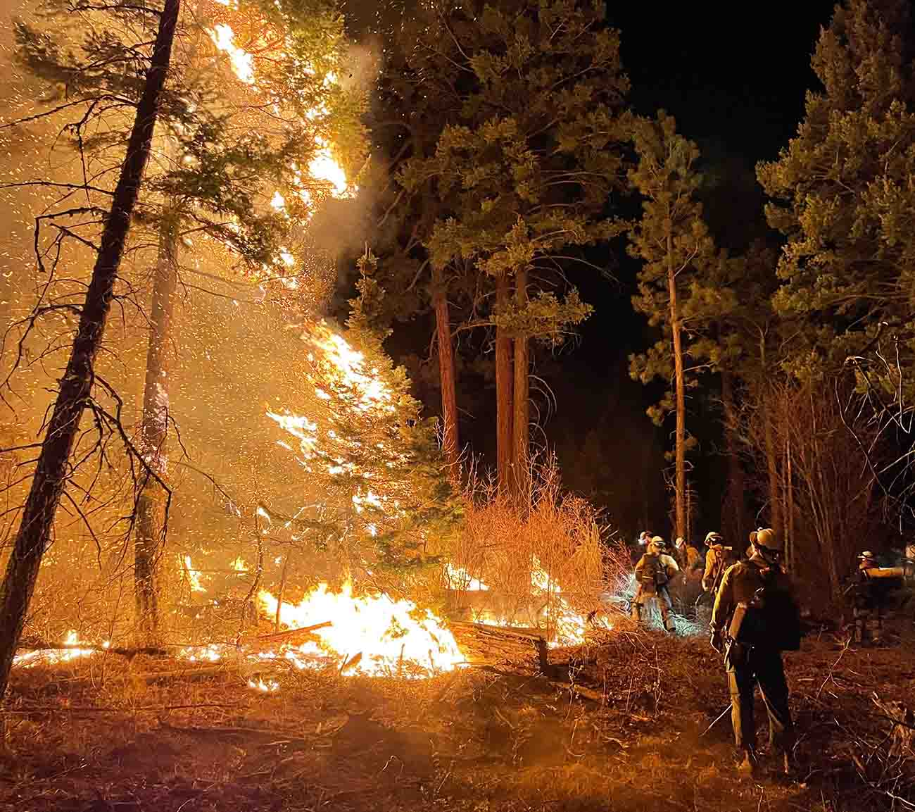 Lone Peak Hotshots conduct a burning operation on the Cerro Pelado Fire in Northern New Mexico, May 10, 2022. Inciweb.
Calf Canyon / Hermits Peak Fire
The Calf Canyon / Hermits Peak Fire made large runs on the north side Tuesday. The area that spotted over Highway 518 a couple of days ago east of Holman spread six miles farther north. Another slopover occurred Tuesday northwest of Holman and ran four miles to the north. When the fire was mapped at 11 p.m. Tuesday the fire had not spread east of the 434 road.
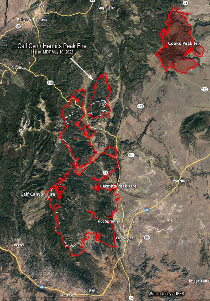 Map of the Calf Canyon / Hermits Peak Fire. The red line was the perimeter at 11 p.m. MDT May 10, 2022. The white line was the perimeter about 24 hours before.
On the south end east of Barillas peak, an area that has been very active recently, it moved another two miles to the south.
Tuesday afternoon I briefly checked an aircraft tracking website and quite a few aircraft working the fire, thanks to a decrease in wind speeds and turbulence. At that time there were two large air tankers (MD-87s), one very large air tanker (DC-10), four scooping air tankers, at least two helicopters, as well as a lead plane and an air attack.
The blaze has now burned 236,939 acres, an increase of about 33,000 acres in 24 hours, and is now 13 miles southwest of the Cooks Peak Fire.
Cerro Pelado Fire
The map produced by an aircraft Tuesday night found incremental differences in the fire perimeter, but no large additional runs. Most of the changes were due to firefighters conducting tactical burning operations to tie in the fire’s edge to roads or other firelines.
The fire has burned 42,491 acres.
8:08 a.m. MDT May 10, 2022
 Map of the Calf Canyon Hermits Peak Fire. The red line was the perimeter at 10:24 p.m. MDT May 9, 2022. The white line was the perimeter about 24 hours before. The orange areas represent intense heat when the fire was mapped.
The Calf Canyon / Hermits Peak Fire near Los Vegas, NM grew substantially in two areas Monday and had burned a total of 203,920 acres by evening. On the north side, the spot fire east of Highway 581 that was 200 acres Sunday night spread east for more than 5 miles and burned about 8,000 acres by Monday night. When the fire was mapped at 10:24 p.m. Monday firefighters were holding it at the 434 road.
 Calf Canyon – Hermits Peak Fire, Division Bravo at 2 a.m. May 10, 2022. Cory Carlson.
On the southwest side 9 miles west of Las Vegas near the A18A road the blaze spread for another mile and a half to the south. Operations Section Chief Todd Abel said Monday evening that the fire in that area was still within contingency firelines that have been constructed further south. Hand crews and engines are in the area improving lines and protecting structures.
To see all articles on Wildfire Today about the Calf Canyon / Hermits Peak Fire, including the most recent, click here.
On Monday there were scattered areas on the west side of the fire that were very active late in the afternoon.
The very strong wind prevented air tankers from working Monday, but Mr. Abel was gratified that a small Air Attack plane was able to find an altitude without too much turbulence and was able to reconnoiter and provide information to personnel on the ground. At one point we saw on an aircraft tracking site that the aircraft was orbiting at 20,000 feet, much higher than their usual operating altitude.
The Cerro Pelado Fire 7 miles southwest of Los Alamos was active Monday on the northeast and southeast sides. It was mapped Monday night at 42,491 acres, an increase of about 1,500 acres, and still had not crossed Highway 4.
 Map of the Cerro Pelado Fire. The red line was the perimeter at 10:24 p.m. MDT May 9, 2022. The white line was the perimeter about 24 hours before. The orange areas represent intense heat when the fire was mapped.
Nearly all of New Mexico is under a Red Flag Warning Tuesday due to strong winds and low humidity.





