


Updated at 5:28 p.m. MDT May 18, 2022
 Red Flag Warning for the Calf Canyon / Hermits Peak Fire, May 19-20, 2022. NWS.
The National Weather Service has taken the unusual step of issuing a Red Flag Warning one and two days in advance for the Calf Canyon / Hermits Peak Fire 21 miles east of Santa Fe, New Mexico. The prediction is for winds gusting from the west and southwest at more than 30 mph with single digit relative humidity. Similar conditions will exist at least on Thursday for the area of the Black and Bear Trap Fires in southwest New Mexico.
Updated 12:10 p.m. MDT May 18, 2022
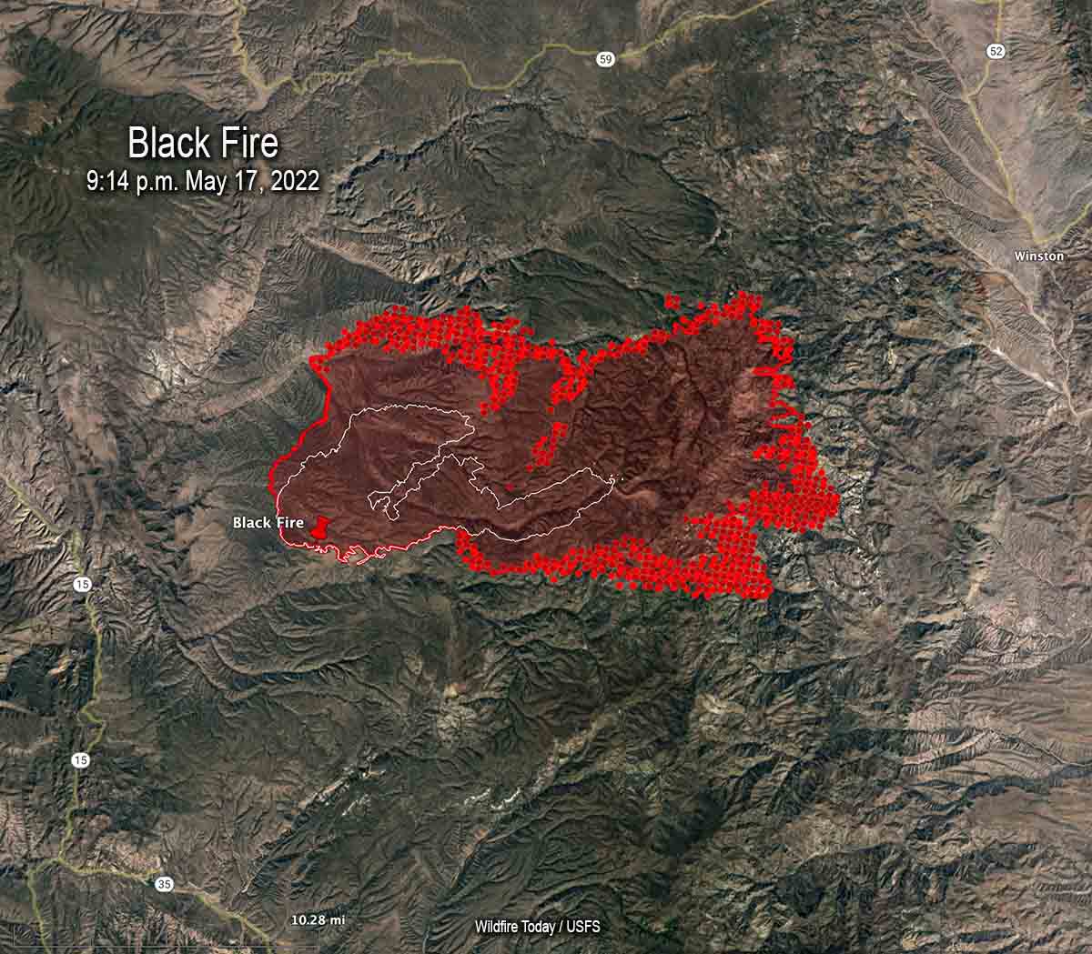 Map of the Black Fire. The bright red dots represent heat detected by a satellite at 2:48 a.m. May 18. The red line is the perimeter at 9:14 p.m. May 17. The white line is the perimeter about 48 hours before.
On Wednesday the northern half of New Mexico is under a Red Flag Warning. Isolated dry thunderstorms are predicted for portions of New Mexico, Texas, and Colorado.
Red Flag Warnings Wednesday.
Chance for isolated dry thunderstorms in portions of NM, CO, & TX.
From the NWS:
“Thunderstorms are expected across portions of the central Rockies this afternoon. Storms should be dry with the potential for new lightning induced fire starts.” pic.twitter.com/kT4KwlJC27— Wildfire Today ? (@wildfiretoday) May 18, 2022
The Calf Canyon – Hermits Peak Fire 21 miles east of Santa Fe, NM was active on the west side Tuesday, but there was very little significant activity on the east side between Mora and Las Vegas.
The Cerro Pelado Fire 25 miles west of Santa Fe was relatively quiet Tuesday. There has been no major spread for several days and a satellite was only able to detect one large heat source early Wednesday morning.
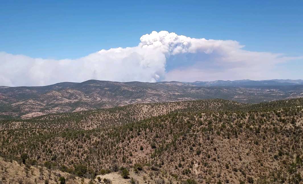 Black Fire, May 16, 2022. IMT photo.
The Black Fire (see map above) 28 miles west-northwest of Truth or Consequences made another large run to the east Tuesday adding another 21,000 acres to bring the total up to 77,360. Fuel treatments and wildfires that have occurred over the last 20 years may slow any major spread to the north, west, and south, but the NIFC database shows no significant history of fire east of the incident.
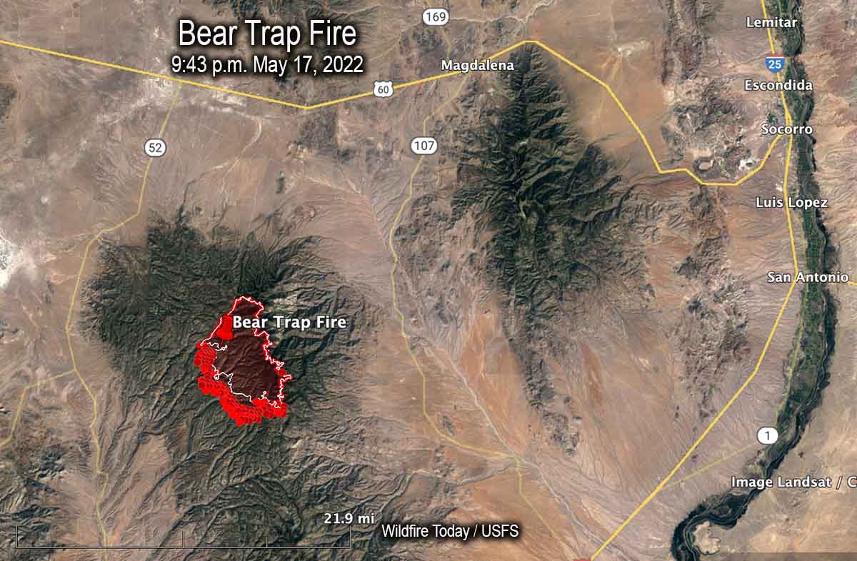 Map of the Bear Trap Fire. The bright red dots represent heat detected by a satellite at 2:48 a.m. May 18. The red line is the perimeter at 9:43 p.m. May 17. The white line is the perimeter about 24 hours before.
Another fire in southwest New Mexico, the Bear Trap Fire, is 34 miles southwest of Socorro. It spread southwest on Tuesday and was mapped Tuesday night at 15,215 acres. The fire is surrounded by fuel treatments and prescribed natural fires on all sides except for the southwest — which is where the most of the spread has occurred during the last couple of days.
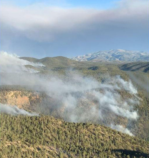 South side of the Bear Trap Fire, May 16. IMT photo.
5:10 p.m. MDT May 17, 2022
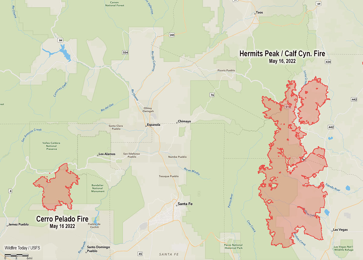 Map showing the location of the Cerro Pelado and Calf Canyon – Hermits Peak Fires, the evening of May 16, 2022.
High temperatures and very low humidity on Tuesday kept most of the large wildfires in New Mexico very active.
Calf Canyon – Hermits Peak Fire
The Calf Canyon – Hermits Peak Fire 21 miles east of Santa Fe has become the largest fire in the recorded history of New Mexico. At 299,565 acres it has eclipsed the previous record set by the 297,845-acre Whitewater and Baldy Fires when they burned together in May of 2012 in Southwest New Mexico. On Tuesday it was again putting up a large smoke column while a 5 to 20 mph wind gusted out of of the northwest, west, and southwest at 25 mph. The humidity dropped to 10 percent in the afternoon.
Cerro Pelado Fire
On Monday most of the fire activity on the 45,605-acre Cerro Pelado Fire was on the northwest and southeast sides. On Tuesday the fire 25 miles west of Santa Fe was putting up much less smoke than the Calf Canyon – Hermits Peak Fire, judging from the Satellite photo below taken at 3:56 p.m.
 Smoke plumes from New Mexico fires at 3:56 p.m. MDT May 17, 2022. NOAA.
Black Fire
On Monday the Black Fire 30 miles west-northwest of Truth or Consequences made a significant run to the east from Forest Road 150 and crossed the Black Range Crest at Diamond Peak. On the west side of FR 150, crews are having success constructing fireline. The fire remains north of Black Canyon. It was very active Tuesday, pushed by a 10 mph wind gusting out of the southwest at 20 to 24 mph while the relative humidity was 5 percent. It has burned 56,132 acres since it was reported May 13 at 9 p.m.
 Map showing the location of the Black Fire, the evening of May 16, 2022.
Bear Trap Fire
Since it started May 1 the Bear Trap Fire has burned 15,215 acres 34 miles southwest of Socorro. It is nine miles south of the Very Large Array radio astronomy observatory.
 Black Fire May 16, 2022. Jeff Zimmerman.





