(UPDATED at 7:35 a.m. PST November 13, 2018)
Since the article below was published the California Department of Forestry and Fire Protection has released a map that shows the status of structures affected by the Camp Fire. The new map is still incomplete and is a work in progress.
(Originally published at 8:48 a.m. PST November 12, 2018)
The town of Paradise, California has released a partial list of structures that have been destroyed or at least 50 percent damaged in the Camp Fire. The surveys to assess the damage are ongoing and so far the list only covers 695 structures. The official estimate is that 6,453 homes have burned.
(To see all articles on Wildfire Today about the Camp Fire, including the most recent, click here.)
As of Sunday afternoon the Butte County Sheriffs’ Office had confirmed 29 fatalities in the burned area, while 228 people are still considered missing and unaccounted for. Some of the missing could be in shelters or no longer have cell phones. More than 100 were removed from the list after they were found.
The Sheriff’s Office has set up phone lines for a Missing Persons Call Center where the public can provide and receive information about missing individuals.
The numbers are:
530-538-6570
530-538-7544
530-538-7671
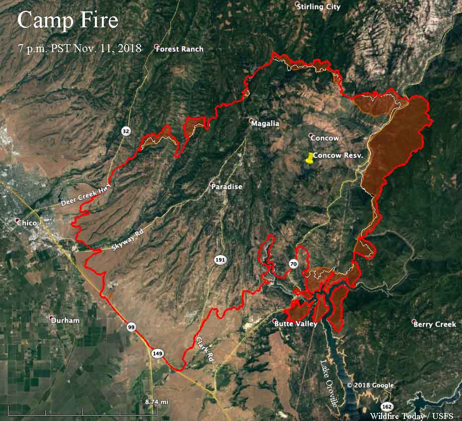
The Camp Fire was very active on the east side Sunday, spreading for over two miles east of Concow and spotting across the north end of Lake Oroville. The east side was less active, but still added about 1,000 acres southwest of Magalia.
CAL FIRE is reporting that the fire has burned 113,000 acres, but the agency often intentionally under-reports the size of large fires by 10 to 15 percent.
The homes of at least 53 firefighters burned in the Camp Fire, according to the International Association of Fire Fighters. The organization set up a disaster relief center for firefighters in Chico and so far have helped more than a dozen emergency responders.
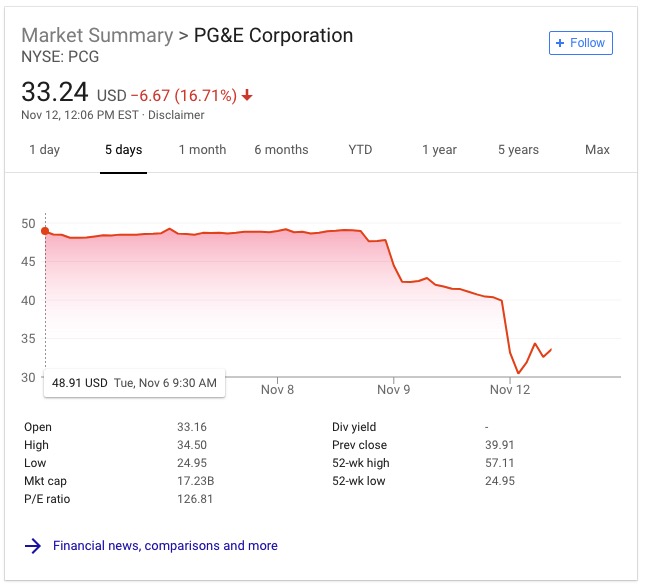
Pacific Gas & Electric disclosed to the Public Utilities Commission that one of their high voltage power lines had a disruption in service on Pulga Road near the Camp Fire at 6:15 a.m. the day it started, November 8. The fire was reported at 6:29 a.m. In the following days the stock price plunged 33 percent.