9:53 a.m. PDT August 21, 2021

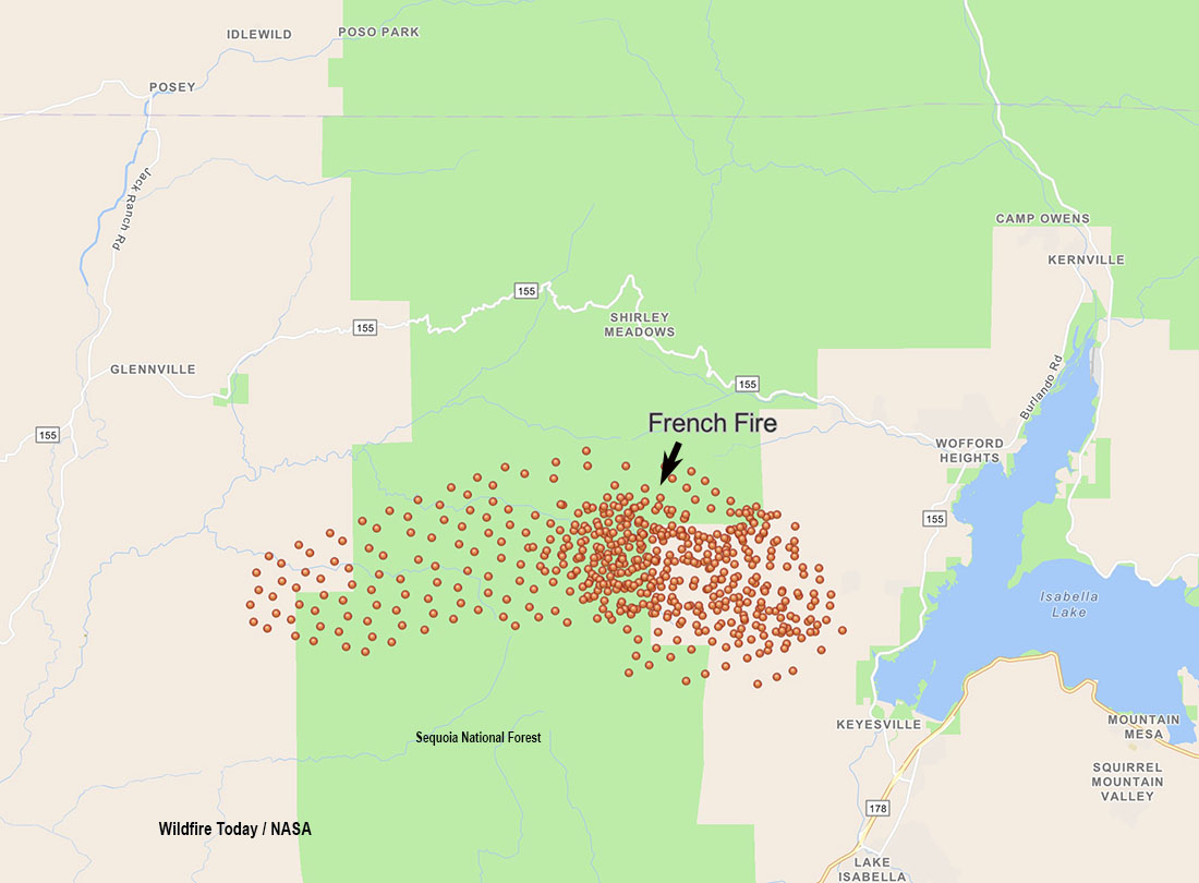
Friday night the French Fire west of Isabella Lake near Kernville, California grew a bit to the north and southwest while under the influence of a light and variable wind from the south, east, and southeast. (See the map above) The relative humidity which was in the 30s and 40s Friday rose into the 40s again Friday night.
The weather forecast for Saturday calls for stronger winds in the afternoon, 11 mph out of the northwest gusting to 16 mph, with the relative humidity around 40 percent. By 6 p.m. the humidity will begin climbing rapidly, reaching 80 percent by 8 p.m. and remaining above 60 percent the rest of the night.
To see all articles on Wildfire Today about the French Fire, including the most recent, click HERE.
The Incident Management Team reports that the fire has destroyed two structures and burned 11,295 acres. They expect the fire to continue to move toward the communities of Alta Sierra, Alta Sierra Ski Resort, Isabella Highlands Community, Dutch Flat Community, and surrounding areas. Evacuations are still in effect.
Resources assigned to the French Fire Friday evening included 28 hand crews, 52 fire engines, and 5 helicopters for a total of 883 personnel.

6:22 p.m. PDT August 20, 2021
The French Fire in Kern County, California started Wednesday, August 18, around 4:30 p.m. on the west side of Lake Isabella. (See map above.) On Thursday firefighters were faced with shifting winds driving the fire in several directions, but in the afternoon wind from the southwest and later the south pushed the fire northwest and north.
Friday morning 5 to 10 mph east and northeast winds gusting at 12 to 18 drove the blaze to the west and northwest, but after 3 p.m. 8 to 12 mph winds gusting out of the south at 15 to 18 mph pushed the fire vigorously to the north.

The fire burned over the location of the Shirley Peak camera, but hours later it was still transmitting images of very dense smoke through a dirty lens.
At about 3 p.m. Friday InciWeb reported the following evacuation orders:
- Wagy Flat Road east to Lake Isabella, between Old State Road south to Keyesville.
- Keyesville south, from the intersection of Black Gulch Road and Forest Route 26S06, continuing east to Highway 155.
Kern County has posted an evacuation map.
Friday morning the fire was mapped at 4,272 acres, but the push to the north in the afternoon likely added significantly to that number.
Thursday evening resources assigned to the fire included 15 hand crews, 47 engines, and 5 helicopters for a total of 650 personnel. On Friday the number of personnel had increased to 809.
The GOES-17 satellite could easily photograph the smoke plume Friday afternoon as the intensity increased significantly.